
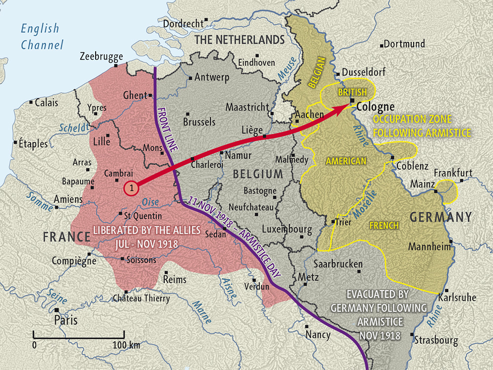
A hundred years ago the armistice was signed ending World War I. One of the more interesting maps showing the situation at the time is from New Zealand History.
 The front line on Armistice Day is shown in purple. The gray area to the east was evacuated by Germany after the Armistice was signed. Yellow areas are parts of Germany that were occupied by Allied Forces. Germany was given two weeks to evacuate the gray area and four weeks to withdraw their forces across the Rhine. Lands to the west of the Rhine were occupied as shown as well as three 30 km zones around the bridges at Cologne, Mainz and Koblenz. These areas were to be occupied for 15 years according to the Treaty of Versailles. However, the occupation was ended a little early, in 1930.


No comments:
Post a Comment