Wednesday, January 31, 2024

Indigenous Languages-Part 3

Here is part 3 in what was meant to be a two part series. In between my last two posts, Vivid Maps posted a map of indigenous languages. I think this was just a coincidence. I only saw their post yesterday and I don't think they saw or were reacting to what I posted. Anyway this is a pretty interesting map, originally from Reddit.  

User aofen did a nice job here though the number of languages represented makes it impossible to have a distinguishable color scheme. Especially since the colors run into each other.

The languages chosen for this map have over 25,000 speakers. Southern Quechua (darker yellow on the map below) has the largest number of speakers at 6.9 million. Guarani also has an impressive reach with 6.5 million and is one of two official languages of Paraguay. It's area closely fits the boundaries of that country. Most of these languages are primarily spoken in rural areas.

Some of these languages can be found in the Living Dictionaries site highlighted in my last post. In some cases I suspect the spellings are a bit different because there are some very similar names. 

NOTE: A lot of research went into this map. I have not had the time to verify any of it and am assuming a high level of accuracy and good faith here. One can never be certain with online sources.


Wednesday, January 24, 2024

Map of Endangered Languages - Part 2

Last week's post showed a huge number of indigenous languages throughout the world. Here is a summary (via the Living Tongues Institute) showing hotspots of endangered languages.

The above site has a companion living dictionaries site where you can find a language by map,

zoom closer for more detail,
 

 and open its dictionary.

When opening the dictionary you can see and listen to the pronunciations of the indigenous words.
If geography is not your thing (what?) you can search the sidebar for a specific language.


Wednesday, January 17, 2024

Map of Endangered Languages

Languages become endangered when parents teach a more dominant language to their children. This clickable map can be found on Ethnologue, a language reference guide and a good place to spend part of this International Decade of Indigenous Languages

Hover over a language to see the name,

and click for more information,

including a language profile page.

This map can be a bit overwhelming with dots for over 3,000 languages. Here an overall one showing the percent of indigenous languages that are endangered.
The "western world" (plus Australia, New Zealand and Japan) is where these languages are the most endangered. Interestingly many western European countries are in the low zone, though the number of indigenous languages in these countries are pretty low to begin with. It is likely that many languages in this region are already extinct.

Finally if 3,000+ points is not enough for you here is a map of 7,168 living languages from the same site.

There will be more on this subject next week - stay tuned!

Wednesday, January 10, 2024

Below the Ice

This past fall scientists uncovered a vast landscape that has been "frozen in time" under the Antarctic Ice Shelf. Here is a nice graphic from phys.org.

The topography was determined by a combination of radio wave echoes and satellite images. This landscape, more than 2 kilometers below the ice has remained untouched for over 34 million years though global warming is threatening to expose it. The landscape was home to forests, river valleys and probably animals before being buried under ice. This landscape is less well known than that of Mars according to glaciologist Stewart Jamieson. 

Here is another view of the topography under the ice via Nature.


Wednesday, January 3, 2024

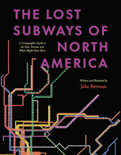
The Lost Subways of North America

A new book by Jake Berman, The Lost Subways of North America explores the history of unbuilt and discontinued transit in 23 cities in the United States and Canada. Mexico is not included because "Mexico's urban history is so unlike that of the United States and Canada." 

Cities are divided into four categories, pre-automobile, automobile era, Canadian cities (they mostly avoided downtown freeways and followed a different urban pattern) and smaller systems of historic interest such as Rochester, the only city (known to the author) to build a subway and then abandon it. The book contains many maps drawn by the author using "period-influenced design and typography". Berman set up a website where you can view and purchase these maps. Here is one example showing the 1945 New Orleans streetcar network with a fake ad for war bonds.

Here is an example of Cleveland's proposed downtown loop which was never completely constructed. "The bonds were issued, and the voters approved, but the County Engineer did as much work as possible to make sure that highways were built instead." 

The current system maps are shown with a more modern looking design.

Look for your favorite transit system here.