Showing posts with label vancouver. Show all posts

Wednesday, January 3, 2024

The Lost Subways of North America

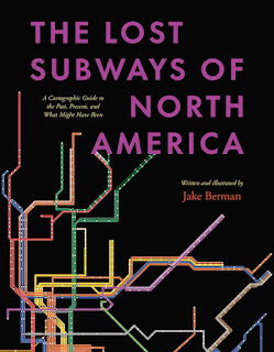
A new book by Jake Berman, The Lost Subways of North America explores the history of unbuilt and discontinued transit in 23 cities in the United States and Canada. Mexico is not included because "Mexico's urban history is so unlike that of the United States and Canada." 
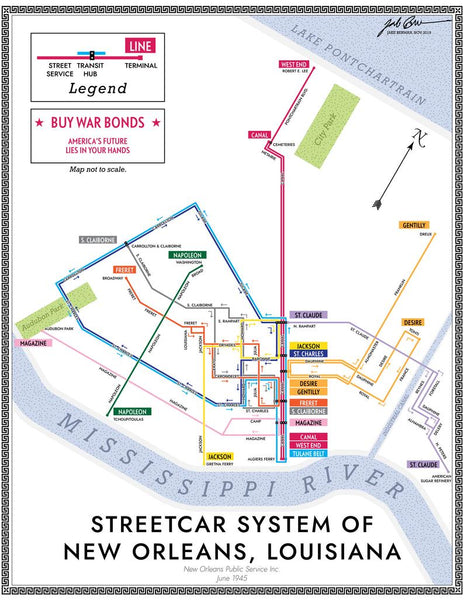
Cities are divided into four categories, pre-automobile, automobile era, Canadian cities (they mostly avoided downtown freeways and followed a different urban pattern) and smaller systems of historic interest such as Rochester, the only city (known to the author) to build a subway and then abandon it. The book contains many maps drawn by the author using "period-influenced design and typography". Berman set up a website where you can view and purchase these maps. Here is one example showing the 1945 New Orleans streetcar network with a fake ad for war bonds.
Here is an example of Cleveland's proposed downtown loop which was never completely constructed. "The bonds were issued, and the voters approved, but the County Engineer did as much work as possible to make sure that highways were built instead." 
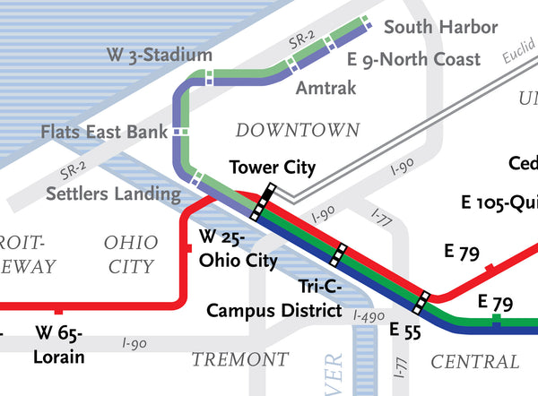
The current system maps are shown with a more modern looking design.

Look for your favorite transit system here.

Thursday, November 30, 2017

Vancouver Neighborhoods as Simpsons Characters

The following tweet from a Vancouver radio station woud benefit from a map so I made one.

I don't know many of these neighborhoods and this may not be an original idea but I like it. I made the assumption that "West Van" is the municipality of West Vancouver, not the west side of the city. Upon further research it looks like the west side is called "Vancouver West" so I guess it's OK.

Interesting that no actual Simpsons show up in this tweet-that's some deep character mining!

The base map is from OpenStreetMap - I "artified" it a bit and lightened up the colors so the characters show up better. Unfortunately some of them came out pretty light. With more time I could make them pop a little more but I'm having a busy week. Another problem is the need to zoom way out to accommodate the eastern suburbs. Here is another version focused on the main parts of the city-because I want to see for myself what it looks like.
Agree?

Wednesday, January 4, 2017

Oh the Places You Should Know

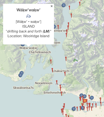
Oh the Places You Should Know is an Sḵwx̱wú7mesh (Squamish) language place name map of southwestern British Columbia.The non-profit Kwi Awt Stelmexw created it as a means to reclaim Squamish language and cultural identity. The map is for education and advocacy, and not intended to make any claims on the land.
The map has clickable icons, listing the Sḵwx̱wú7mesh name, pronunciation, meaning and a description of the location. The main region covers the Howe Sound and the Vancouver area's Burrard Inlet and English Bay coasts. Early transportation was primarily by canoe so most place names were given to landmarks and locations visible from the water.
 http://ohtheplacesyoushouldknow.com/index.html
The region includes downtown Vancouver. The beach at the foot of Denman St was "good under foot." I was there once and I do remember it being good under my feet.
http://ohtheplacesyoushouldknow.com/index.html
Many of the names were collected from a 1937 Sḵwx̱wú7mesh place names map developed by the City of Vancouver and August Jack Khatsalano of the Squamish Nation. An update of the map is available for purchase here.
https://www.kwiawtstelmexw.com/shop/24-x-26-khatsalano-place-names-poster/

Wednesday, April 10, 2013

Subways of North America

xkcd once again embraces their love of maps with Subways of North America. While I've seen similar subway map mashups, I've never seen them connected before.


These inter-city connections create some wonderful highlights. Here are some of my personal favorites:

The Cleveland Circle (Boston) to Cleveland shuttle - passing through West Trenton, this shuttle would be a nice easy way for me to leave work and go visit my Mom. West Trenton's location along Lake Erie just beyond South Harbor is also a bit curious.

The Green Line extension from Cambridge to Montreal - if it even makes it to Medford that would be remarkable.

The extension of the Market Street elevated subway line in West Philly/Upper Darby from 69th Street to Long Beach and LA.

The Rocky Mountain Tunnel (at sea level) connecting Chicago's O'Hare airport to Oakland.

A couple of extremely long subway tunnels from Atlanta and Miami to Mexico City.

The Puerto Rico submarine from Staten Island to San Juan and the connection from Jamaica (Queens) to Jamaica.

The Springfield Monorail connecting to nowhere, not even North Haverbrook.

There's lots of other things to explore including tunnels in the Caribbean,  "covertly repurposed" Amtrak lines, strangely renamed Red Line stations in Quincy, Mass. and a graveyard for passengers killed by closing doors - have fun exploring!

Wednesday, February 17, 2010

Map of the Week-The Olympics GeoView

I love the Olympics. Especially the Winter Games. However, the Official Vancouver 2010 site seems to lack a basic map showing the various event locations. Each venue has a diagram and map of the immediate area but there's nothing that shows the whole picture*. For example, where is Cypress Mountain? Is it on the way to Whistler? These are the kind of questions that maybe only I care about.
*Note: it turns out there are some better maps - see update at the end of this post

There is an interactive map but when you click it you get this googly mess:

It's way too busy (until you use the filters) and you have to click each site to get the name. Also when you click a site it changes your view to accommodate the large block of googleized text.

OK - enough complaining. What they do have that is interesting is the GeoView. This is an interactive world map showing the countries by medal count, events and number of athletes with various filters. So for example you can see the number of ski jumpers per country or the total number of female athletes in the 1984 Olympics. Here are the countries by total number of athletes at the 1924 Winter Olympics in Chamonix, France.


This is the same map for the 2010 Olympics.


I also like the cute sustainability diagrams. Here is one for Whistler Creekside. An explanation is here.


And of course who can't resist the Google Earth views with building models?


Or the Google street views?


Finally, here is the current medal count (subject to change at any minute).


 **********************************************
Update (Feb 25th) :

There are some decent maps after all. I'd like to think they made these available because I complained, but probably they've been up on the site all along. They're just difficult to find. You have to go to the Transportation section of the site. These are large Acrobat .pdf files that may take some time to download. Here are the thumbnail images.


Wednesday, January 27, 2010

Map of the Week-Take the Long Way Home

Today is Day 90 of the Vancouver 2010 Olympic Torch Relay. It's a long way from Victoria to Vancouver. You could just take the ferry but that's no fun! This route takes 106 days and goes through every province, territory and major city in Canada.


The Vancouver 2010 Olympic web site has an interactive map where you can see the route details and link to events, photos and stories. The route looks more like a child's connect the dots drawing than a map but cartographic accuracy is not their first priority. Here is today's route through British Columbia from Revelstoke to Salmon Arm and then on to Kamloops.


Clicking the red dot at Kamloops brings up a detailed map showing this evening's route and festivities. The detailed maps also feature cartographic accuracy!


Wednesday, January 6, 2010

Map Changes for 2010 and beyond


New State in India?


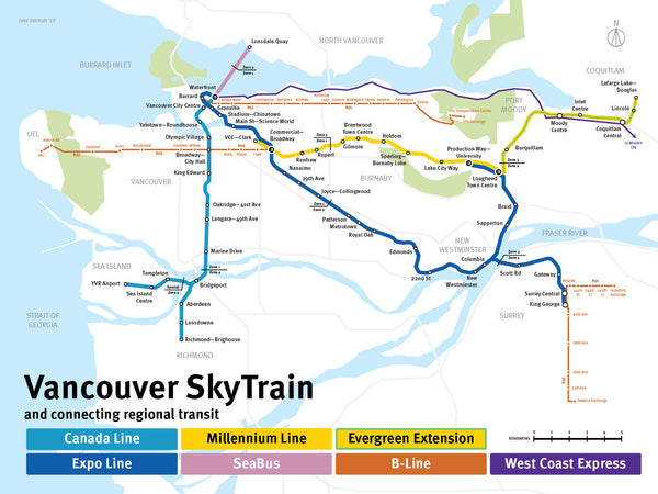
New transit line for Vancouver                                           

  - opened in August, 2009


Proposed Purple Line would serve the Maryland suburbs of Washington, DC.  The line would run from Bethesda to New Carrollton.


Michigan's attorney general has asked the U.S. Supreme Court to seal off the most direct routes from the Chicago River into Lake Michigan to keep Asian carp out of the Great Lakes.


Stay tuned for these and other exciting map stories as the year progresses.