Showing posts with label education. Show all posts

Wednesday, September 8, 2021

Walking Into a New School Year

This odd graphic from the Biennial Survey of Education in the United States 1934-36 shows the number of school days per state.

The states appear to be marching off to school. In order to see if there's any pattern I tried making my own map. However, many states are not shown.


 Some other interesting graphics from the report show the states grabbing bags of money,

children lining up in the schoolyard by year,

and the percentage of students enrolled in private schools - overrunning the Northeast.

 The report is available here.

Wednesday, January 21, 2015

Spain vs. New Zealand Antipodes School Map

As young geo-nerds, my brother and I started digging a hole in our back yard in Pennsylvania. Eventually we hoped to reach China because that was the cliche of the time. This ignores the fact that you probably wouldn't dig precisely downwards without a level and if you did, you'd melt when you got to the earth's core. We also didn't realize that a straight dig downwards would have put us off the coast of western Australia. This is our antipode - the opposite side of the earth.

Most places don't have very interesting antipodes - North America is opposite the Indian Ocean and most of Europe and Africa is opposite the Pacific. Spain, however shares an antipode with New Zealand. The Antipodes Spain/New Zealand School Map is a tool teachers can use to teach geography and hopefully set up relationships between schools on opposite sides of the globe.
 Zoom in on a location and you can see the closest opposite school.
In a large city such as Madrid, the idea breaks down a bit as you have numerous schools competing to partner with New Zealand's Weber School, located in a low density area with few nearby schools.

The area around Wellington, New Zealand, being opposite the triangle between Madrid, Salamanca and Valladolid, has much better opportunities for anitpode sister schools though most of the city is paired with the Miguel De Cervantes School.  
- via Maps Mania

Wednesday, April 25, 2012

Cupcake Map of the World

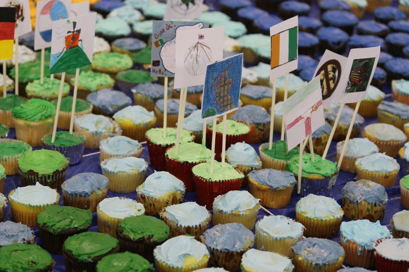
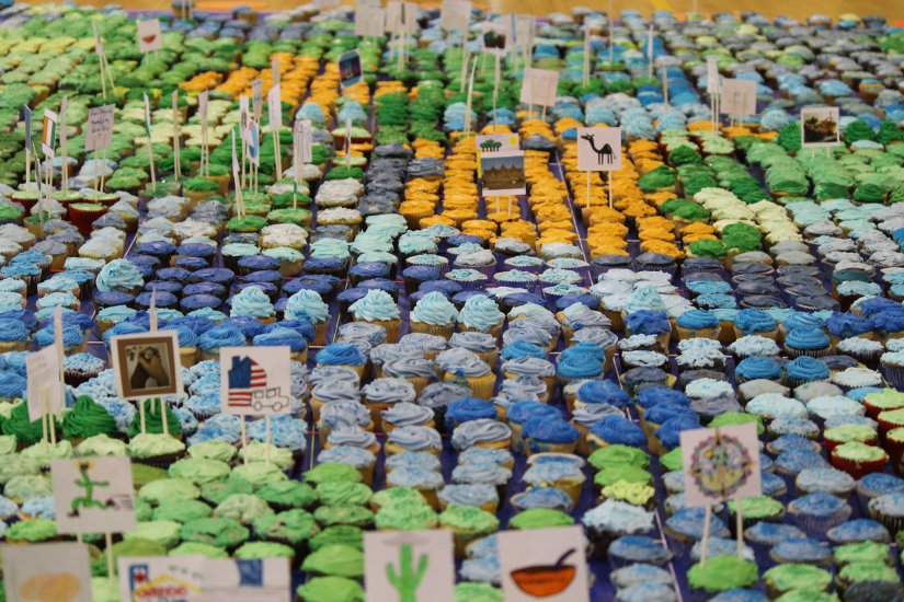
Eighth grade geography students at my niece's former school, H-B Woodlawn in Arlington, Virginia created a map of the world with cupcakes.


An article on ARL now describes the process:
The 80 students each chose a country to write a report about, focusing on one particular issue in that country. They made signs for their cupcakes on the map, which correspond to the individual reports that are hung on the wall of the gym.
Visitors who made a donation to help fight hunger took the cupcakes home and fought their own hunger. 
Here are some close up views:


Wednesday, April 14, 2010

Bizarre Map Challenge-Vote Soon!

The Department of Geography at San Diego State University is hosting the Bizarre Map Challenge. This challenge is open to high school and college students. Bizarre refers to "maps that are strikingly out of the ordinary." The top 10 finalists were selected this week and the 1st, 2nd and 3rd prizes will be announced April 27th. Subject matter includes personal ads, Thai formation skydiving records, French North American settlement patterns, staycation destinations and opinions about health care. Some of these maps are large files and can be slow to download. I made lower resolution images of some of my favorites.

Here is a map of California where the spacing and color of the county names is used to reflect physical geography. Letter spacing is tighter in the mountainous areas to give the illusion of topography.


Next is the "earth in reverse" - a map that uses a reverse color scheme, making the highest mountains look like the deepest parts of the ocean and vice versa. The map is also flipped so that south is up and west is to the right.


Finally, a map showing the locations of missed connections in Burlington Vermont from the I-Spy feature that appears in the personal ads of the Seven Days weekly.