Showing posts with label vermont. Show all posts

Thursday, November 3, 2022

Thirty Day Map Challenge 2022 - Days 1-3

November is back and that means another #30DayMapChallenge, making a map each day based on a given theme, For more background on the challenge see this post from last year. Here are the first three days as posted on my Twitter.

Day 1 - Points
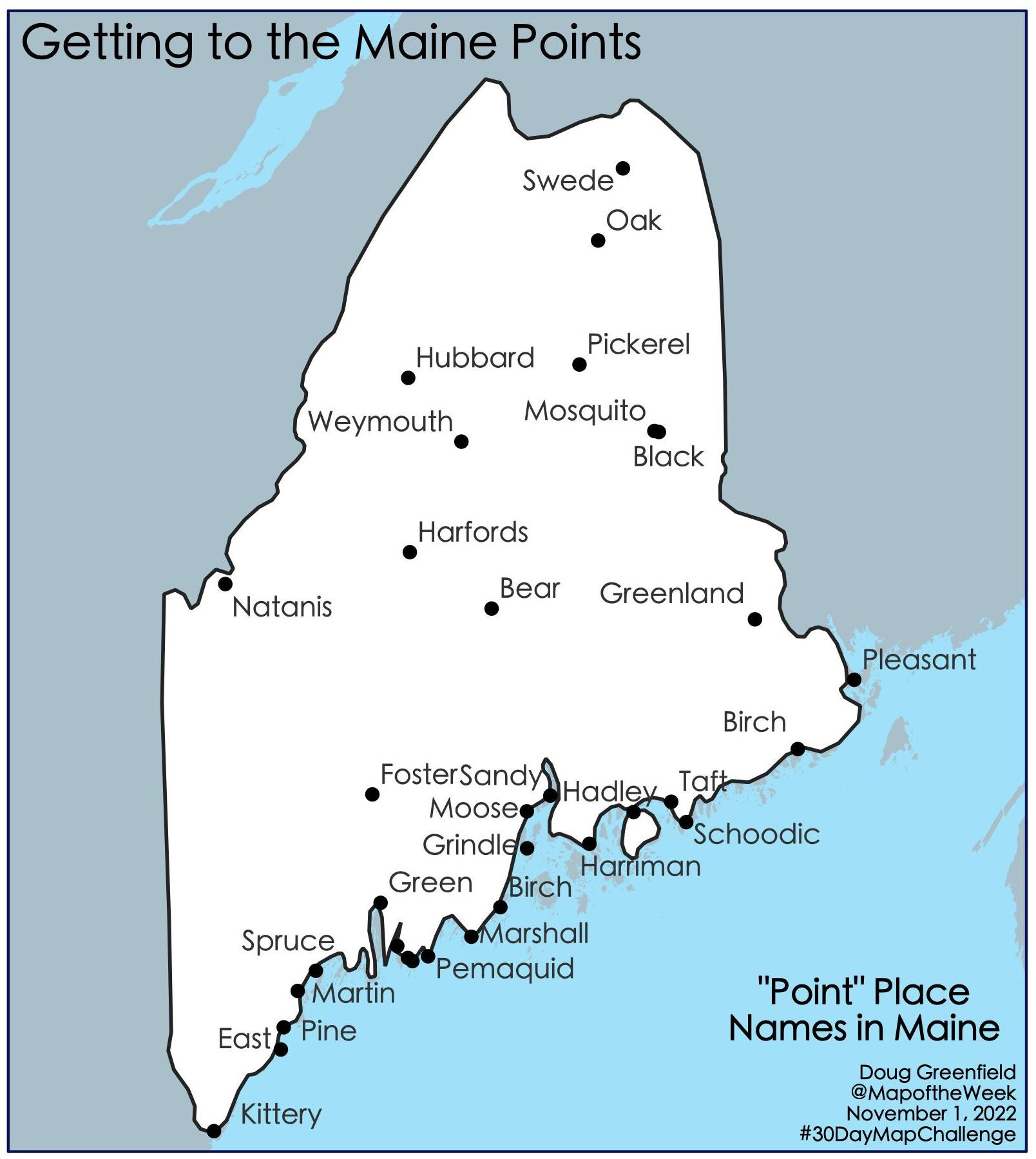
The original points came from the Maine Geodata Library. However, these only included towns with “point” in the name which are not many. For example, there is no town called "Pemaquid Point" so it was missing. I got some additional names from various web searches. The inland points were particularly difficult to find-most of these are on lakes. In the final map some of the points got dropped by the auto-label function to reduce clutter, so this is not a complete list.

Day 2 - Lines
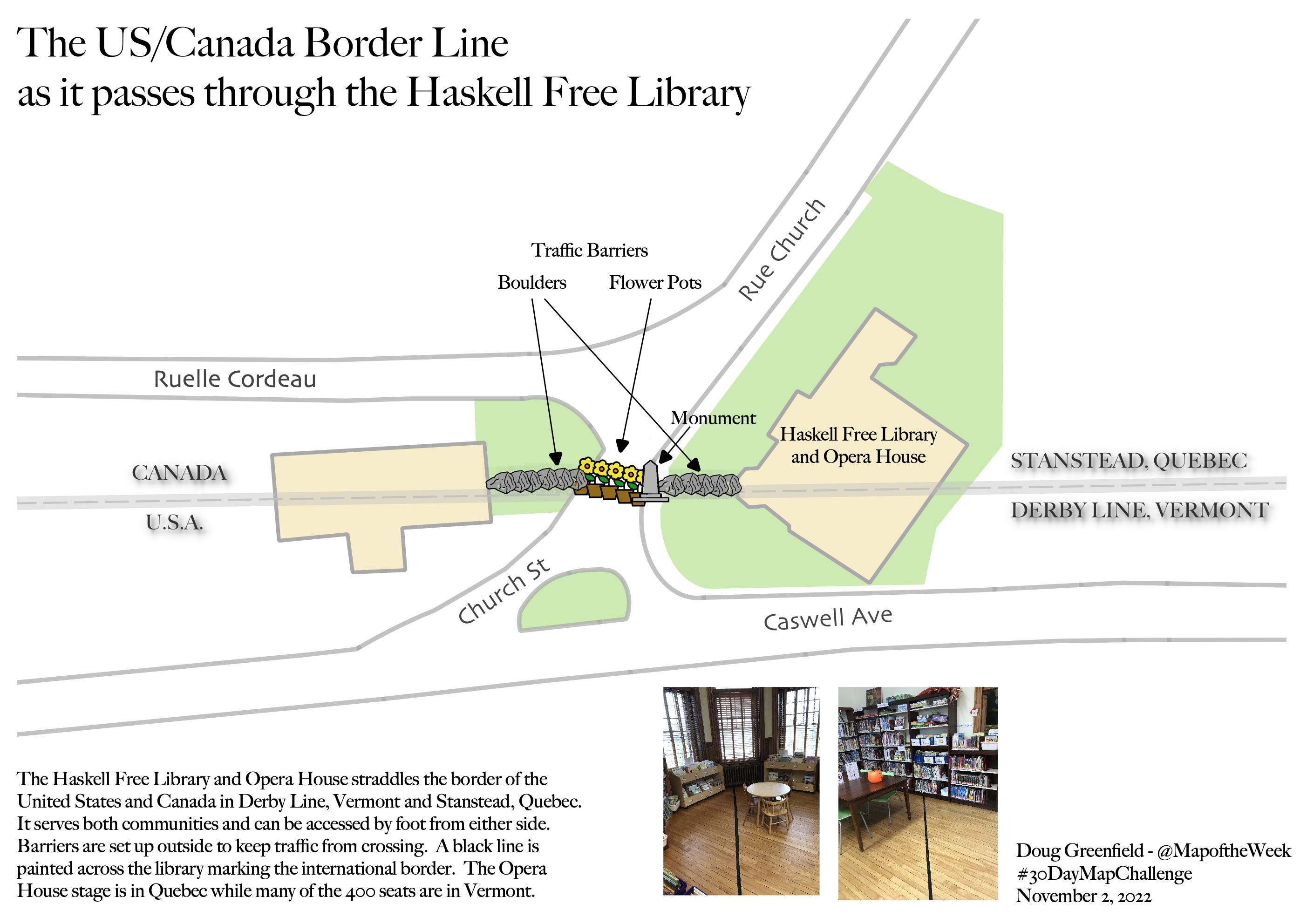
This is the most wordy map I’ve ever made. I’m not a huge fan of the overly information-dense National Geographic style maps because it’s just way too much to take in, but this map needs some explanation. I’ve been fascinated by the Haskell Free Library and how it straddles the US-Canada border. A few years ago I finally had a chance to visit it. I took the photos of the black line marking the border and generated the data myself as most of it did not exist from what I could find.

I had to drop my accuracy hangups to make the map more legible. Originally I had all 9 flower pots in their exact right locations. It was unreadable so I spread them out a bit but eventually found that I needed to get rid of a few to keep the map from being a messy jumble.

Day 3 - Polygons
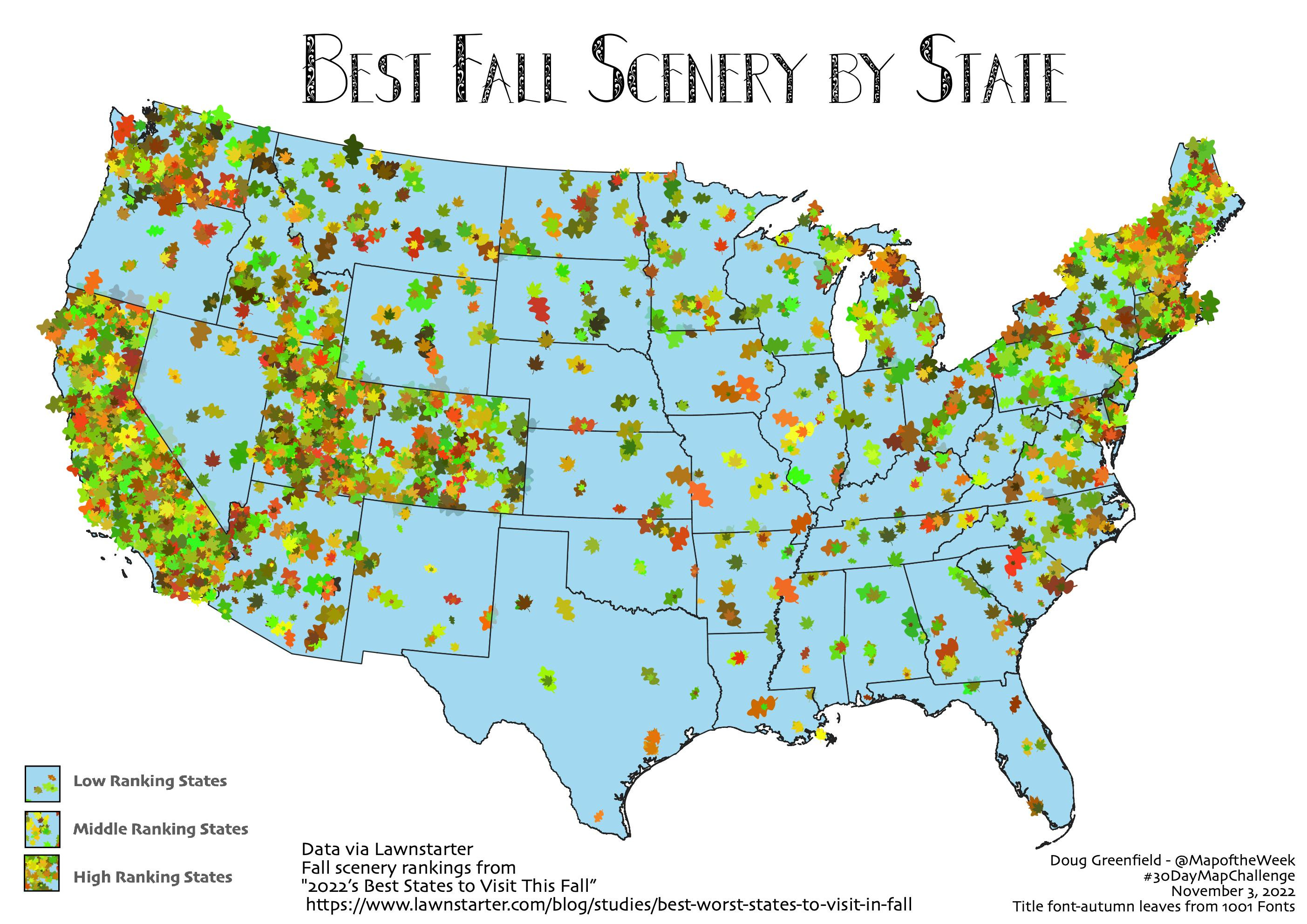
While Lawnstarter is not necessarily the world’s foremost data site, sometimes you have to go where the data is. I was trying out this leaf coloring scheme with its random colors and angles so I looked for a fall foliage by state guide. I found a best “fall scenery” ranking by State from Lawnstarter 2022’s Best States to Visit This Fall  There’s an overall ranking but there is also one specific to fall scenery.

I had trouble coming up with an ideal density function in limited time so some of the larger states look a bit more sparse to the benefit of states like Delaware.

I’ll have many more of these to post throughout November.

Tuesday, November 21, 2017

New Hobby

Anyone who reads this on a regular basis can probably tell that I have a fondness for hand drawn maps. However, I haven't made any myself since I was a child making up imaginary places. Even in my pre-computer carreer, we used special drafting equipment (a subject for another time) to make maps. I recently began trying my hand at making maps with colored pencils. Back in the old days we would trace over US Geological Survey maps on a light table. These maps are not traced but drawn freehand after carefully looking at some DeLorme atlases.
Burlington, Vermont-Doug Greenfield, 2017
Above is a map of Burlington, Vermont, a city I have spent a fair amount of time in and know the landscape of well. I used a similar color scheme to the DeLorme atlas and was pleased with the level of accuracy. Not every street is shown, just enough to give an idea of the street pattern.

Next, I tried Williamsport, Pennsylvania, a city that I've only driven through the edges of but one with an interesting settlement pattern.
Williamsport, Pennsylvania-Doug Greenfield, 2017
This was more of a challenge as I am much less familiar with the area. The map got gradually less accurate and more impressionistic the further I dug into it. It was liberating when I gave up on the idea of trying to be too accurate.

I don't have a new project yet but I hope to continue in a more impressionistic direction and to find a different map source to add some variety of looks and scales.

Sunday, January 19, 2014

Live From Jerry's World

I am at the Brattleboro Museum in Vermont admiring Jerry's World, a fantasy map extravaganza that's been highlighted in a previous post.  

In Jerry's World voids threaten the urban areas,

fortunately some places are protected by a defense wall. 

A little history about a specific void is detailed in the text below.
Outside the main urban area things get wavier

At the far edges you might find beer and graham crackers.

Here's a whole wall of it. 

This map shows it all with the section shown here outlined in orange. The entire world (purple outline) is on exhibit at Summerhall in Edinburgh, Scotland until January 24th. This exhibit will be at the Brattleboro Museum until March 8th.


Wednesday, March 21, 2012

A Six Pack of Maps

Spring beer season is here. If you look at the bottom of your six pack you may find a nice map directing you to the brewery. Just be careful not to turn it over when it's full of bottles. I like these maps because they are usually hand drawn (or in a hand drawn style) making for creative alternatives to the googly, bingy maps we've become accustomed to. Of course, most brewing companies use a google type map on their web sites so I had to scan some six packs.

Here are six examples from beers that are commonly available here in the Northeastern USA. I have a few others from farther afield that will make for a future post. This is not meant as an endorsement of these beers. They are just the ones I've bought in six packs recently and some of them were better than others.

From Maine - the Belfast Bay Brewing Company.

Magic Hat in South Burlington, Vermont. I've actually been on this tour!


Victory - Downingtown, PA. A highly schematic map where 202 and 30 are really important while 476 and Route 1 don't make the cut.

While in Pennsylvania stop by Troegs - look for a beer bottle by the railroad tracks. They're moving to Hershey* though so this map may not help you anymore.


Circling up to western New York, there's the Southern Tier Brewing Company.

Finally we head back eastwards for a colorful map from the Ithaca Beer Company.


If you find a nice map on the bottom of your six pack send it over and maybe I'll put it in a future post.

*UPDATE - since I began collecting these Troeg's has in fact moved so I had to buy another six pack of their beer. Here's the map to their new digs with I-81's westward sweep greatly exaggerated for artistic effect - try doing that on a google map!


Wednesday, September 7, 2011

Map of the Week - About that Tropical Storm

My colleagues in Vermont are doing a great job providing timely data for disaster responders under difficult circumstances. The Vermont Center for Geographic Information's offices have been flooded for the last week and a half but they are up and running. Meanwhile the Vermont Agency of Transportation is publishing and updating this detailed map every 12-24 hours.


Here's a detail from Wardsboro, a town I've spent time in and that was until recently inaccessible.


It's a big, colorful mess over there but they're still hoping to be open for the upcoming foliage season when things get really colorful.

Wednesday, April 14, 2010

Bizarre Map Challenge-Vote Soon!

The Department of Geography at San Diego State University is hosting the Bizarre Map Challenge. This challenge is open to high school and college students. Bizarre refers to "maps that are strikingly out of the ordinary." The top 10 finalists were selected this week and the 1st, 2nd and 3rd prizes will be announced April 27th. Subject matter includes personal ads, Thai formation skydiving records, French North American settlement patterns, staycation destinations and opinions about health care. Some of these maps are large files and can be slow to download. I made lower resolution images of some of my favorites.

Here is a map of California where the spacing and color of the county names is used to reflect physical geography. Letter spacing is tighter in the mountainous areas to give the illusion of topography.


Next is the "earth in reverse" - a map that uses a reverse color scheme, making the highest mountains look like the deepest parts of the ocean and vice versa. The map is also flipped so that south is up and west is to the right.


Finally, a map showing the locations of missed connections in Burlington Vermont from the I-Spy feature that appears in the personal ads of the Seven Days weekly.

Wednesday, February 25, 2009

Map of the Week - Heavy Metal Cartogram

DJ Yuletide from Melting Point Radio (WRMC-Middlebury College) presents this heavy metal cartogram. It is based on the number of bands registered on Encyclopedia Metallum. While obviously the bigger countries have more bands, the per capita metal leader was Finland with 2300 bands. Bands like Diarrhea Vomit and Life is My Enemy.


Questions arise such as:
Why is so much of the area of the USA taken up by Alaska? -
Do they really have more bands there than the rest of the country
or is it the "mediocre" Mapresso cartogram applet?
Does Greenland represent Denmark or Greenland?
Are all Europeans metal crazed freaks?
What are those 3 islands floating down near Antarctica? -
Or are they just there to look creepy?

Wednesday, October 31, 2007

Map of the Week #98 - The Vermont Foliage Cookie

My wife bought a Vermont shaped cookie cutter and as we were making Halloween cookies last night I tried to color mine along the lines of the foliage maps that we had seen in the newspapers up there a few weeks ago. While it did not match the state's tourism web site animation very well, it did come somewhat close to the September 25th foliage map on the bottom right. In fact it was close enough that Amy was able to guess what the map was showing on the first try.