Showing posts with label arizona. Show all posts

Wednesday, October 27, 2021

More Cross Stitch Maps

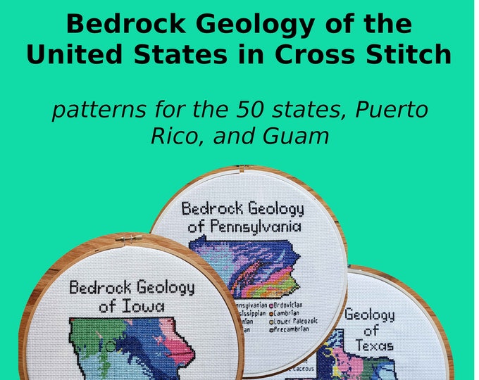
 One of the talks I enjoyed at this month's North American Cartographic Information Society Conference was from Kara Prior, who uses maps to create cross stitch pattern designs - on sale on her Etsy shop.

She details the process in her talk - now available on YouTube. The idea is to take a map and make it as low resolution as possible while still conveying information. That way you see the individual squares. Here is a screen shot from the video illustrating this.

One of my favorites is the bedrock geology of Arizona. The colors really jump out - some of them look like they were taken from the state's flag.

 
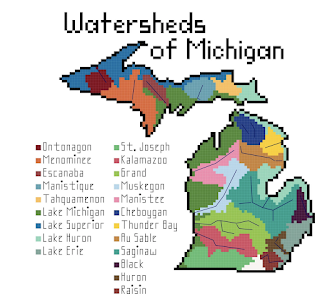
She also has bathymetry and watersheds as well as several other, non-map patterns. The watersheds can be quite simple such as New Jersey,

or much more complicated.

I'll end with some bathymetry examples


Wednesday, September 11, 2019

Deaths in the Desert

Since 1999 over 2000 people (probably even more since this source is a few years old) have lost their lives crossing the desert in southern Arizona. Traditional border crossings have been closed off forcing many migrants to cross in desert areas - places where the government thought the harsh conditions would deter people from crossing. These deaths have been documented by the Tucson Samaritans, a group dedicated to saving lives
http://www.tucsonsamaritans.org/uploads/5/5/9/6/5596304/2015-2016-whole-area_orig.jpg
 Here is a closeup of the Ajo sector for a better idea of the terrain.
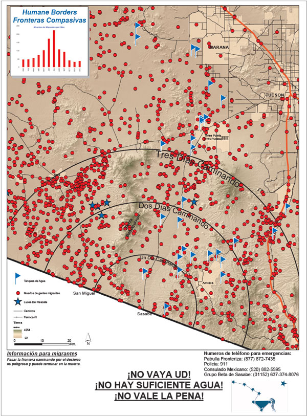
Humane Borders, another group of volunteers trying to save lives, made posters for distribution on the south side of the border warning potential undocumented migrants of the dangers they face trying to cross through the desert on foot. The text in Spanish at the bottom translates to “Don’t do it! It’s hard! There’s not enough water!” The posters include estimated walking times from various entry points, as well as the sites of migrant deaths and the location of water stations.
https://www.humaneborders.org/wp-content/uploads/sasabe_poster_913_2016.jpg
They also created maps showing deaths that include location of water stations, rescue beacons and land ownership,
as well as an interactive map where you can look up names and filter deaths by location, year, land type or cause. Here are deaths from exposure.
A closeup of an area near the Organ Pipe Cactus Wilderness gives a good sense of how bleak the landscape is.
A click on the points helps to humanize each death-something many of our politicians are unwilling to do.


Wednesday, January 31, 2018

Map Acquisition Syndrome

Map Acquisition Syndrome - is there a cure? I have been given so many maps by people clearing out their apartments that it has overwhelmed my filing system. Many have been sitting in shopping bags for a year now while I figure out what to do with them. Here are some paper maps people have foisted on me knowing I can't say no. This is therapy-before I file them away I need to show off my bounty.

Insight FlexiMap of Budapest - so shiny it's hard to get a good picture.
For contrast here's the Budapest tourist agency map  
Details from the shiny flip side of the Insight map - the road to Lake Balaton and the Metro
 
Rand McNally map of Italy-an undated map from a Fodor's travel guide. The credits mention a Stuttgart office that no longer seems to exist. 
Here is a newer Fodor's map of Naples. This one produced by the British map company Lovell Johns.
Old Quebec - a nice pictorial map  
"Marco Polo" map of Russia. These maps come with stickers so you can mark places of personal interest. 
Same company-Thailand, Vietnam, Laos and Cambodia. Note the delicate task of naming Saigon. 
Official City of Rome tourist map with pictorial details.
Monte Carlo tourist agency map
Bilbao Turismo
Bilbao Transportes 
AAA map of Tucson
Sorry for the poor quality of some of these pictures. I don't have a professional map photography setup. There are many more - stay tuned for another installment.

Wednesday, July 16, 2014

40 Maps That Won't Explain Anything-Part 4

This is the final (for now) installment of this series. However, there are so many of the "40 Maps That Will Increase Your Earnings and Change Your Life" pages out there now that I might be compelled to put out some bonus editions of these in the future.

It was pointed out to me that some of the maps in Part 3 actually explained things. I will try to fix that situation with less meaningful maps this time.

31. The Provinces of Bolivia
32. Darts being thrown at random provinces in Cambodia to illustrate PowerPoint Maps Online

33. Detail from the Austin Music Map - love that purple river!
http://austinmusicmap.com/
34. The Interstate 11 Corridor proposed to connect Phoenix and Las Vegas.
http://www.washingtonpost.com/blogs/govbeat/wp/2014/02/25/nevada-governor-wants-to-make-new-interstate-a-presidential-priority/
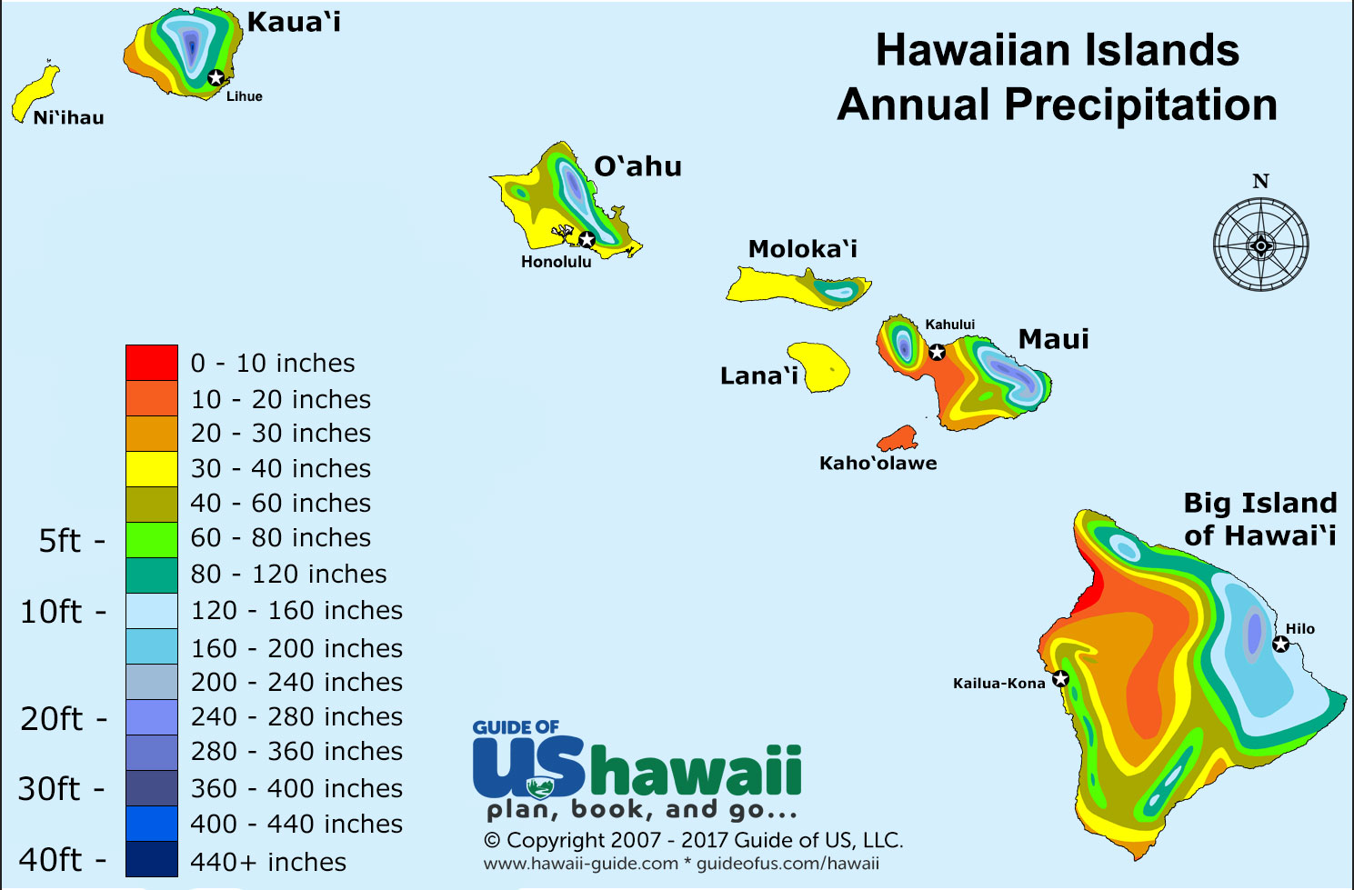
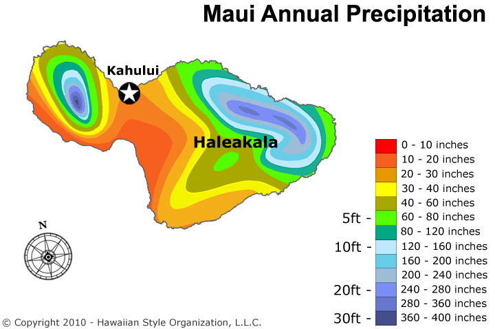
35. Psychedelic precipitation map of Hawaii. With a bonus Maui blowup.
36. Hawaii refrigerator magnet from Shop in Paradise.
http://wwww.siphawaii.com/Prodimages/Magnet_Map_Hawaii_old_large_SIPhawaii.jpg
37. The High Sierra region from Visit California - I like their maps and we just visited this region.
38. World placemat for "bigger kids"  from the Reader's Catalog. Got cliches?
http://cdn.shopify.com/s/files/1/0067/8732/products/Placemat_World_1024x1024.jpg
Here's the Western Hemisphere zoomed in. Note the atrocious placement of New York City. Guess where this company is located? If their 646 area code is any indication they're based in New York City!
39. Speaking of New York City - here are the Trees of Prospect Park. On the Prospect Park page you can  click on a tree to get details and pictures, but then it would be a map that explains something so be careful!
40. Time to put this series to sleep with some White Comic Map bedding from Debenhams. If you zoom in on the image you'll see that the "map" is a series of comic book images.
http://int.debenhams.com/us/product/white--comic-map--bedding-set/306907936480/

Wednesday, March 26, 2014

March Hot Dog Madness

Several years ago I featured the West Virginia Slaw Mapping Project, showing the regional pattern of hot dog preferences. As an update, the West Virginia Hot Dog Blog claims to have won last years National Hot Dog and Sausage Council March Madness style regional hot dog tournament.
http://wvhotdogs.com/slawbig.html
I will give them the benefit of the doubt but I could not find the above image or a winner listed on the Council's facebook page. They did make the final against the Coney dog. I used MapBox to create some geographical context for the contestants:

New York - As far as I can tell New York hot dogs are pretty ordinary but since New Yorkers think everything that comes from their city is special, it had to be on the list.


 Seattle - I don't know this for sure but I think this is a hot dog with cream cheese. They put cream cheese on everything up there. No wonder they lost in the first round.


     The famous West Virginia Dog. It is a "heavenly creation" that is topped with onions, hot sauce and usually cole slaw, though as the slaw mapping project shows, not in every county.


Georgia - I don't know this one but Delish, my source for this and the
Sonoran and KC dogs, describes an "Atlanta" dog. It's a hot dog with cole slaw. Sounds like they're copying West Virginia who they lost to in the first round. Nice Atlanta Flames logo in the poster =>


The Coney - This bit of geographical confusion is actually a Michigan thing. If you go to West Lafayette Boulevard in Detroit you will find a Coney Mecca of sorts. I know this is true because I've seen it with my own TV. The Coney (Coney Island style?) is slathered with chili, onions, mustard and cheese.


The Sonoran is a southwestern inspired dog from Arizona. The dog is wrapped in bacon and has jalapenos and pinto beans among other stuff. I've never had one but it has possibilities.


The Kansas City is a Reuben sandwich hot dog topped with caraway seeds to mimic the rye bread. Supposedly these are served at Royals games though I went to that stadium several times in the 1990s and never saw such a thing - maybe it had not been invented way back in the days of yore.


The Chicago dog. Basically you empty the contents of your refrigerator onto a hot dog. I had one of these at O'Hare airport. When I saw someone I knew from Chicago I asked whether the airport experience counted. After telling him the brand of meat served on the dog he assured me I had the real deal.


Oops, they forgot to include the famous Rochester White Hot and probably many other deserving regional varieties.