Showing posts with label north korea. Show all posts

Wednesday, October 20, 2021

Chosin Reservoir Medal of Honor Map

Last week I attended the North American Cartographic Information Society Conference in Oklahoma City-virtually. There are always many inspiring maps to see there and I will likely be highlighting a few over the next few months. Here is a map by cartographer Gene Thorp showing the recipients of the Medal of Honor at the Battle of Chosin Reservoir in the Korean War.


The gold stars are the best available locations of the actions that thirteen service members were awarded for. The battle was a turning point in the early part of the Korean War when the Chinese entered the war and drove UN forces out of North Korea through treacherous frozen mountainous terrain. Thorp used terrain from Google Earth and shows a winter-time scene that does a good job of conveying the conditions. The map was exported to Adobe Photoshop and Illustrator where the annotation was created. 

This map is used by the National Medal of Honor Museum to visualize the extreme conditions these award recipients went through.


Thursday, January 2, 2020

Puposeful Wanderings in Pyongyang

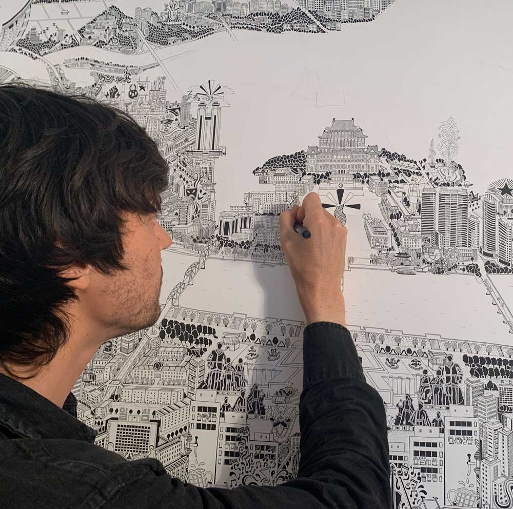
While North Korea begins the year with lots of bellicose bluster here is Artist/cartographer Gareth Fuller's take on Pyongyang, the capital.
https://images.squarespace-cdn.com/content/v1/54e1eff4e4b006178716ee8b/1570883761694-006227M2NG8C7W6LGA1N/ke17ZwdGBToddI8pDm48kKBjrb5R1Q3hpVVXnHcTTzsUqsxRUqqbr1mOJYKfIPR7LoDQ9mXPOjoJoqy81S2I8N_N4V1vUb5AoIIIbLZhVYxCRW4BPu10St3TBAUQYVKcGKuCHgOviFVwLluJDzDVBipMaYKHb8kC-VgsgueAYivQzBU5hUVIxFjxkuDXwM3H/Gareth_Fuller_Drawing.jpg?format=2500w
The artist, who likes to go by just "FULLER" usually begins his work with a very thorough exploration of the places he maps. His "Purposeful Wanderings" is a series of kaleidoscopic maps of the places he has spent time. However in North Korea he was constrained to the government's rules and encouraged to marvel at their socialist wonderland. Here is the Party Foundation Monument,
https://fullermaps.com/artworks/pyongyang
the Ryugyong Hotel, a signature building of the city,
https://fullermaps.com/artworks/pyongyang
and their shuttlecock-like ice arena-kind of a sports mismatch.
https://fullermaps.com/artworks/pyongyang
For more on this project take a look here.
 

Wednesday, March 30, 2016

Strange and Secret Totalitarian Capitals

This past Sunday was the 10th anniversary of Napyidaw, Burma's new capital. I did a post about how the country suddenly moved its capital far into the hinterlands with no explanation and under much secrecy. Much of the city is strangely empty according to those few outsiders who have visited. Totalitarian regimes like to keep their geographic knowledge to themselves. Another example is North Korea's Pyongyang.
http://blogs.loc.gov/maps/2016/03/north-koreas-enigmatic-capital-pyongyang/?loclr=twmap
Unlike Napyidaw, Pyongyang has a long history of settlement but because North Korea was closed off to foreigners after the Korean War, little is known of its recent development. An article from the Library of Congress, Geography and Maps Division shows some of the rare maps available outside the country including this guide for tourists attending a 1989 youth festival.
http://blogs.loc.gov/maps/2016/03/north-koreas-enigmatic-capital-pyongyang/?loclr=twmap
The map is surrounded by pictures meant to highlight power and modernity.
More from the Library of Congress article:
Those who manage to enter the city are chaperoned and follow a strict itinerary; the practice serves to perpetuate both curiosity and mystery. Fortunately, geographic knowledge of the city has been growing by way of satellite imagery. Satellites, however, can only depict but cannot describe. 
 Click for for the full article.

Another country that like Burma suddenly moved its capital to the far northern hinterlands is Kazakhstan. In 1997 they moved the capital from Almaty to the small city of Akmola and then renamed the place Astana, "the capital" in Kazakh. Moving the capital allowed the government to centrally plan a monumental capital city, one full of strange modern architecture.
http://s593.photobucket.com/user/kiraneg/media/Astana_Map_Test_Axis_3.jpg.html
The map above, though hard to read details the top ten architectural wonders of the city in blue. Those wonders are listed on this page, and include the Baiterek Tree of Life (below) as well as the world's largest tent, serving as a mall and entertainment complex and also includes a river, park and beach.
Here is a picture via CNN of the modernistic capital complex.
http://www.cnn.com/2012/07/13/world/asia/eye-on-kazakhstan-astana/
Despite being the world's second coldest capital and being surrounded by many hundreds of miles of mostly empty grasslands, the city does have more life than Napyidaw. It is also much less secretive. Here is a cartoon-ish map of one of the business districts north of downtown, itself a ways north of the capital complex.
http://www.intermovex.kz/images/a_map_en_b.jpg
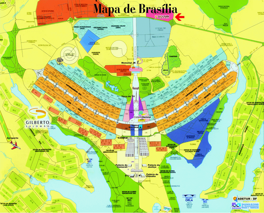
Lastly, I've always wanted to show some maps of Brazil's capital, Brasilia. While not the product of a totalitarian state, it is also a highly designed landscape created from a mostly blank slate. The design is meant to look like a giant bird or airplane. It looks cool on maps and aerial photos. On the ground, however it's a pretty bleak landscape. Here is the original plan followed by a map.
https://en.wikipedia.org/wiki/Bras%C3%ADlia#/media/File:Brasilia_-_Plan.JPG

http://www.viagemdeferias.com/mapa/plano-piloto-grande.gif
Here is a night shot from the International Space Station via Wikipedia.
https://en.wikipedia.org/wiki/Bras%C3%ADlia#/media/File:Bras%C3%ADlia_from_space.jpg
Like these other capitals, they favor modernistic architecture.
https://en.wikipedia.org/wiki/Bras%C3%ADlia#/media/File:Bras%C3%ADlia_Catedral_Metropolitana_noite.jpg
On the ground however, it does not look like a warm, inviting place.
https://sidewalkcity.files.wordpress.com/2010/08/brasilia-img_1564.jpg