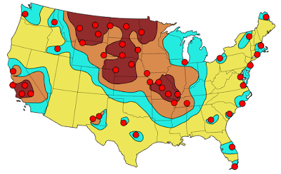
I've lived in many different places in the United States and one thing that people in every place seem to have in common is the belief that their region is a primary nuclear target. I came across this map on a Reddit thread that I can no longer locate. The thread was full of anecdotes from all over the country of people being told that their town was one of the top targets of the Soviet Union back in the Cold War days.
 The map is from the Federal Emergency Management Agency (FEMA) and dated September, 1990. Though I lost the thread, it was posted by Daniel Reetz. Here is the caption
 Reddit is full of these kinds of maps and threads. Some of the maps are based on out of date information and show decommissioned sites. Here is a typical example of one of these maps showing two different scenarios - the black dots are mostly military installations while purple triangles are population centers. The comments are filled with people who are either proud to live in a targeted area or sad that their town isn't important enough to nuke.
 Here is another map focused on the military installations with the colors representing fallout areas.
 Here are evacuation routes for St Louis County via Reddit- this assumes an attack on downtown when there may be various other targets throughout the city and county.
 Of course, the United States was not the only place threatened. Here is a scary map of a 1970 Warsaw Pact plan for attack on northwestern Europe - highlighting the Copenhagen region of Denmark, via War is Boring.
 Australia too-click for link.
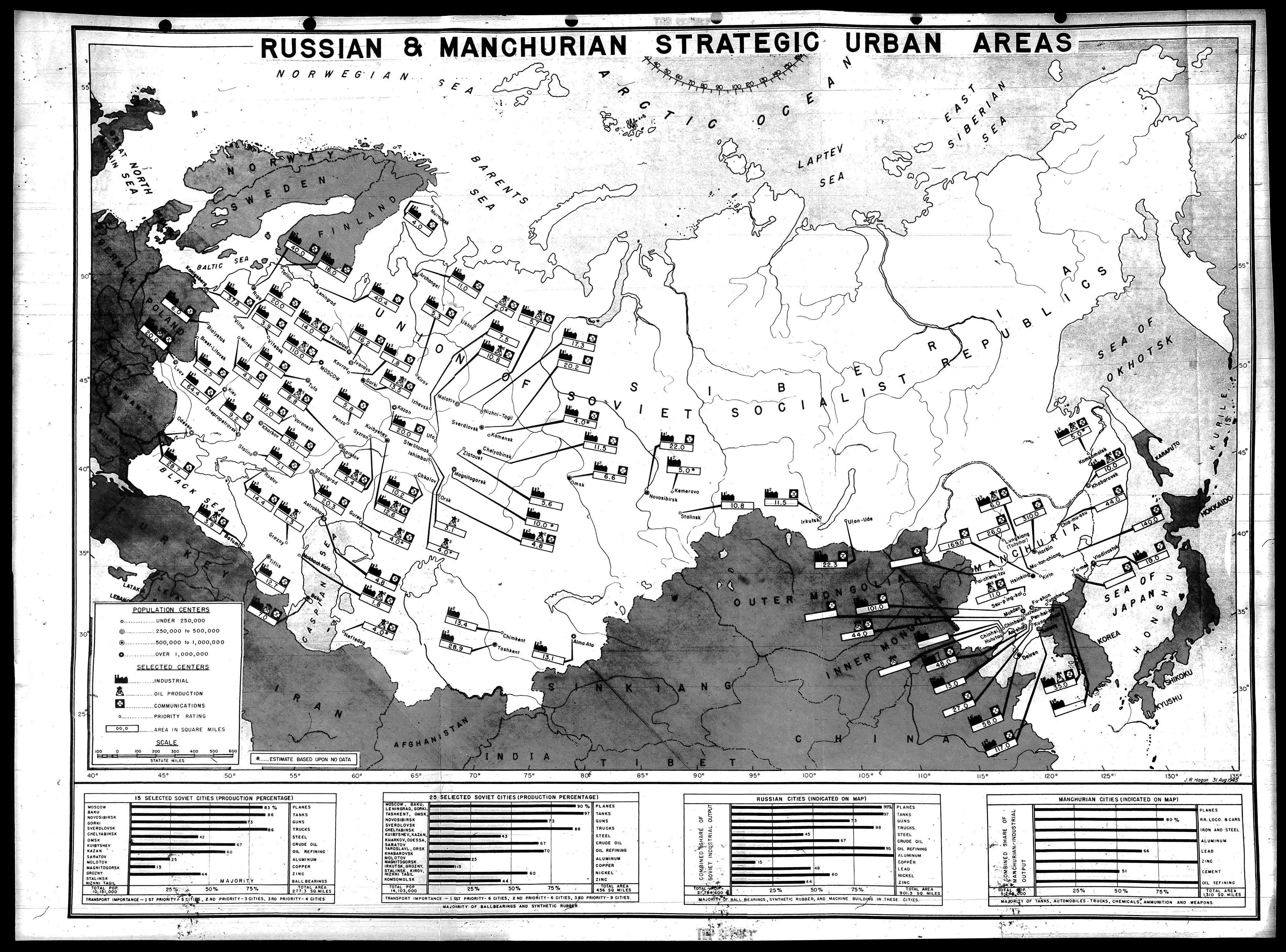
 Here is a very detailed map of places in Russia (and Manchuria) targeted by the United States in 1945.
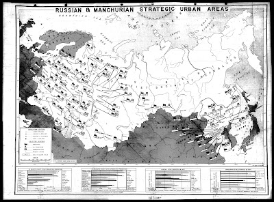 This map is from the Nuclear Secrecy blog, a blog that also features Nukemap,
where you can choose your bomb and location and see where the extent
of destruction. There are more recent maps showing the primary targets in Russia that I am not authorized to
show (though you can Google them) - mostly production facilities for various metals and oil
refineries.
This map is from the Nuclear Secrecy blog, a blog that also features Nukemap,
where you can choose your bomb and location and see where the extent
of destruction. There are more recent maps showing the primary targets in Russia that I am not authorized to
show (though you can Google them) - mostly production facilities for various metals and oil
refineries.
Here is a communist propaganda map showing Russia encircled.
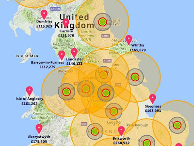 See you in Lancaster, or Aberystwyth.




Here is a communist propaganda map showing Russia encircled.
Finally here is a real estate agent's map of where it is safe to buy real estate in the event of an all out nuclear attack on the U.K.'s to 20 cities - via the Shropshire Star.Poster made in 1951 by the French Communist Party, depicting "US military bases around the world" and the encirclement of the USSR, Eastern Europe, Mongolia & China. Nota bene: Arctic orientation & appearance of Canada, Greenland, Iceland, Alaska, and the Aleutian Islands. #Maps pic.twitter.com/lddG8CV95V— Steven Seegel (@steven_seegel) May 7, 2019