Showing posts with label iraq. Show all posts

Tuesday, May 24, 2016

Lady Anne Blunt in Northern Arabia

In March the Library of Congress posted a series of maps for Women's History Month on their geography and map blog. Their last post was a map showing the journeys of Lady Anne Blunt through northern Arabia.
https://blogs.loc.gov/maps/2016/03/lady-anne-blunt/
Blunt was a British noblewoman who was famous for helping to save the purebred Arabian horse by buying and bringing horses to England. She was the first European woman to cross the Arabian desert in pursuit of these horses. As an interesting side note her mother, Ada King-Noel, Countess of Lovelace is often regarded as the first computer programmer.

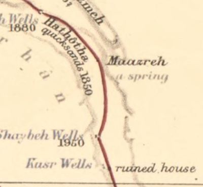
Blunt was not a cartographer but her place-specific descriptions of two journeys, in 1878 and 1879, allowed Edward Stanford, a London bookseller and mapmaker (creator of Stanfords Travel Guides) to create this remarkably detailed map.  It shows not just the physical geography of the land, but cultural features such as irrigation and grazing practices, tribal relations and pilgrimage routes.
Here are a couple more zoomed in views.
You can browse and/or download the entire map online at the Library of Congress.

Thursday, January 23, 2014

New Provinces in Iraq?

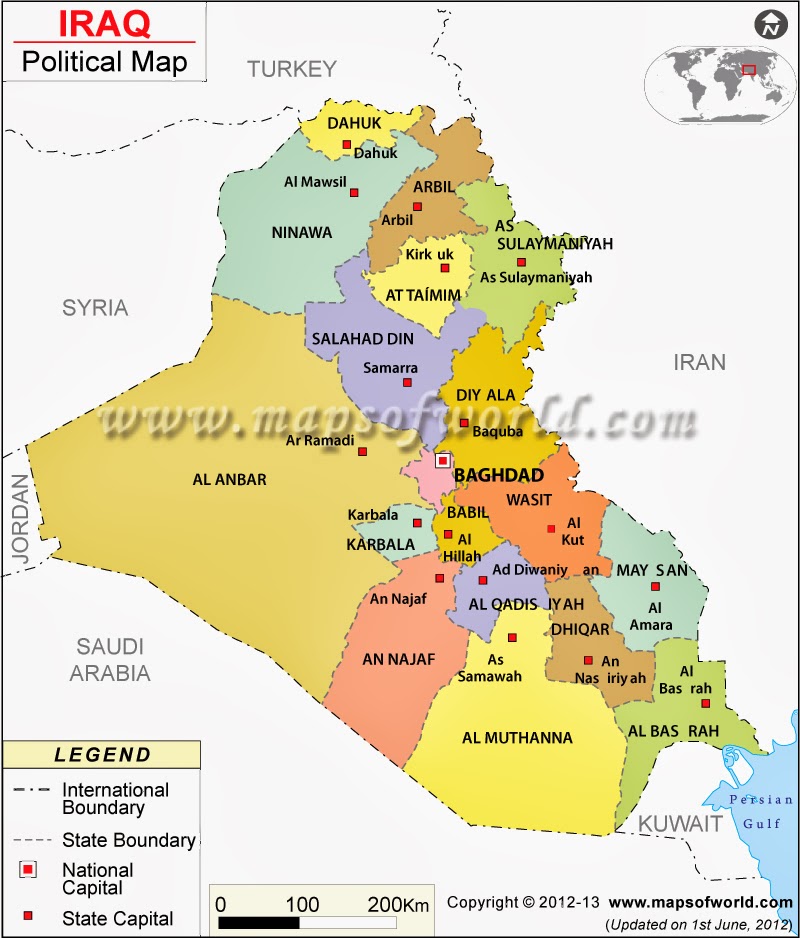
Iraq's Shiite government has decided "in principal" to create three new provinces to address Sunni grievances, counter Kurdish expansion and possibly, to appease Christian and Turkomen minorities. I immediately looked for a map but there is none because the government has only described it in general terms. The idea is to create a province around Fallujah, and two others on the edge of the Kurdish regions, in the Nineveh Plain and around Tuz Khormato. Here is a map from the Public Intelligence Blog showing where these provinces might be.
The text on this map is tiny and weak on descriptions but the color scheme nicely illustrates the ethnic and religious areas and where they mix. The article describes the situation in more depth. The black outline is the area with Christian minorities that could compose the Nineveh Plain province while purple outlines the Turkomen minority areas including Tuz Khormato. Fallujah is the yellow star in the middle of the country. 

The map above does not show the current provinces. To get both the provinces and cities here's a map from Maps of the World. Fallujah is not shown because it is not a capital but it is near the bottom of the "f" in their watermark, between Baghdad and Ramadi. Nineveh is Ninawa on this map.
http://www.mapsofworld.com/iraq/iraq-political-map.html
Finally, for some classic sarcasm there's this map of the provinces of Iraq. The author showed an admirable respect for the actual provincial boundaries.
https://twitter.com/willJens/status/226247406939955200/photo/1


Tuesday, December 31, 2013

I Saw a Peutinger Map Replica at ISAW

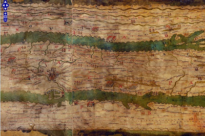
This weekend I was in New York City and had a chance to wander over to the Institute for the Study of the Ancient World (ISAW) to see their exhibit, Measuring and Mapping Space: Geographic Knowledge in Greco-Roman Antiquity.  The exhibit features a 1:1 scale digital replica of the Peutinger Map, the only known surviving world map from the Roman Empire. This is a medieval era copy of a map from Roman times housed at the Austrian National Library in Vienna. The map is over 22 feet long and only about 13 inches wide. The digital replica takes up one wall of the gallery. Here are some photos from my phone. 
The map is centered on Rome. Above are the roads radiating out of Rome, including the Appian Way. It is meant to show a schematic road network and the extent of the empire's control from the British Isles to India and Sri Lanka. The geography is highly distorted to fit the dimensions with the areas closer to Rome much larger and more accurate. Expanses of open water are reduced to narrow channels. Small cities are represented by twin towers while larger ones show temples and other complexes. The largest cities, Rome Constantinople and Antioch are shown with more elaborate symbols. Below is a section in Mesopotamia.
You can see these areas much more clearly on the ISAW map viewer. This allows you to pan and zoom around the entire map, except for the far western edge - missing from the original map. You can also add lines and text digitized from the original for clarity.
http://peutinger.atlantides.org/map-a/
Wikipedia also has a cleaned up high resolution image of the map. The missing western areas were reconstructed by Konrad Miller in 1887-88 and show up with a white background. The original parts of the map are shaded in yellow. The preview image below gives you an idea of the map's crazy dimensions.
http://en.wikipedia.org/wiki/File:TabulaPeutingeriana.jpg

The exhibit at ISAW only goes until January 5th, but hopefully the online resources will remain available.

Wednesday, October 24, 2012

Etch a Sketch Maps

There's been lots of talk about Etch A Sketches in our current presidential election. Those of us in Massachusetts have a long history of watching Governor Romney shake that thing clean.

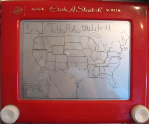
I was looking at something completely unrelated to politics, maps or vintage toys when I came across some wonderful examples of etch a sketch art, including a few maps. Here is the USA, from ivman's blague. This is supposedly from a young child and has a caption of "Tubby_Rules_the_World" - yes all the words have to be connected.


Africa:


Of course, there's an app for this. Here is a world map from the Etch a Sketch Mobile app. Yes the Mercator Projection continues its dominance in the field, pleasing the residents of Greenland.


Romney may want to study this world map after his statement in Monday's debate about Syria being Iran's route to the sea - as if they need one. There's a little problem called Iraq in between. Note all that blue stuff at the bottom of Iran. Picture form the Daily Banter.