In September, 1821 Central America became independent from Spain. The newly formed nation, ruled from Guatemala, dissolved quickly as the countries were not able to unify and were absorbed by Mexico. After Mexico has its own political problems, the Republic of Central America was formed in 1823.
It only lasted until 1840 after Nicaragua, Honduras and Costa Rica separated and formed their own countries. Note that a large chunk of Nicaragua was part of Honduras at the time of this map. This area, the Mosquito (or Miskitu) Coast was part of a British protectorate, then was variously part of the two nations and now split between them. Here is a map of the area as an autonomous region.
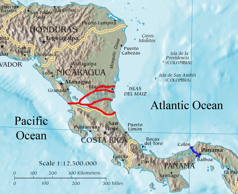
While the Panama Canal celebrates its 100th anniversary this summer, backers planning a new rival canal in Nicaragua hope to break ground by December. The project is a strange mix of centuries of aspiration, globalism and communist politics. President Daniel Ortega granted a 50 year concession to Wang Jin, a Chinese businessman and CEO of the HKND group, to build and manage the canal.
There are six proposed routes from the Atlantic Ocean to Lake Nicaragua, all of them exiting through a newly built canal across the Isthmus of Rivas to the Pacific. The southernmost route through the San Juan river has been rejected for "technical reasons." The river forms the border with Costa Rica and while the entire river is considered part of Nicaragua, many investors would drop out of the project without the approval of the Costa Rican government.
Warnings by legal and environmental experts about the impact and feasibility of the project are dismissed by the Nicaraguan government as political attacks. The Sandinista government has convinced much of the population that this project will bring jobs and wealth to Nicaragua, however most of this wealth may end up in the hands of Wang and his business partners (more details at AP.)
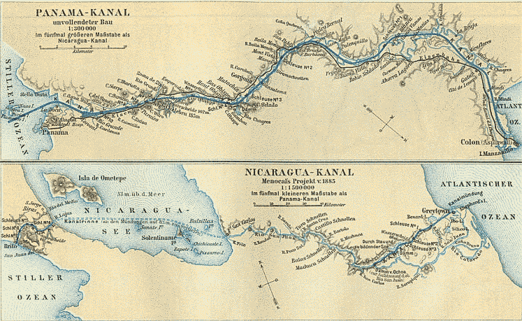
Several colonial powers had looked at constructing a canal through Nicaragua before the canal in Panama was built.
Even after the Panama Canal was built, proposals for another canal
continued to surface periodically. There have also been proposals for a
"land bridge" consisting of railroads and fiber optic cables. Increased
global shipping has reinvigorated the project.
Nicaragua invaded Costa Rica because of an error on Google Maps! At least that's the story being tossed around the internet in articles like this one and in Wired. Of course like many stories, the truth appears to be more complicated and less satirical. Ogle Earth has an excellent summary of the border dispute. Here are some basics:
The eastern part of the border between Nicaragua and Costa Rica is the San Juan River.
The south bank (and sometimes east) of the river belongs to Costa Rica. The river belongs to Nicaragua but Costa Rica is allowed to use it for commerce.
Google maps incorrectly shows the border deviating from the river course giving a part of the Isla Calero to Nicaragua. Bing is basically correct although the alignment between the border and the river is poor.
In late October, Nicaraguan troops occupied a part of this land and began clearing the forest and dredging the river channel.
Costa Rica no longer has an official military to defend their land.
The official map that each country provided to the International Court of Justice both show the same border-along the river's main channel.
After the fact, the Nicaraguan government discovered the google error and used it to justify the troop incursion- from this article(translated.)
Nicaragua also uses historical changes in the course of the river channel to justify their claims
Here is a map of the area claimed by Nicaragua from Managua's La Prensa. The red line is claimed to have been the course of the river in 1897 when US President Grover Cleveland arbitrated a more detailed boundary (than the 1888 settlement) for this area.
However, the UN Settlement includes this map and contradicts Nicaragua's claim. The settlement clearly states that the boundary follows the main branch of the river and not the Taura Branch as claimed by Nicaragua.
Still, if you want to blame google maps go ahead - join the crowd! ************************************************************ UPDATE: Brandon T. sent me this video from newsy about the border dispute. Thanks!