Showing posts with label children. Show all posts

Wednesday, April 6, 2016

Mapping the Playgrounds

On a recent visit to Philadelphia, I came across Zora Plays, a playground mapping and documentation project by Michael Froehlich and his daughter Zora. They began visiting nearby playgrounds in West Philly, eventually expanded throughout the city and have now documented 162 playgrounds. Each has a detailed map.
http://zoraplays.com/?p=1168
This is the Jerome Brown Playground in North Philadelphia. A close-up shows the remarkable level of detail, especially considering how many playgrounds they have visited.
There are detailed reviews of each playground and lots of photos. I'm impressed that they have fearlessly ventured into some pretty rough neighborhoods with open minds and found some very nice playgrounds there - and a few that could use some TLC. Each page includes a linked google map like this,


and there is also an interactive map so you can browse geographically.
https://michaelrfroehlich.cartodb.com/viz/59685cc6-1ed9-11e5-a5bf-0e4fddd5de28/public_map
There is a link to reviews on a similar blog, the Philadelphia Playground Project. That project has covered the city more completely but they didn't map the playground facilities. let alone do it with this level of detail.

http://zoraplays.com/?p=1270
On my childhood visits to my Grandmother's apartment, I remember playing in Rittenhouse Square. There is no playground there (though climbing on the goat statue was lots of fun) so it does not make this list. However, nearby Fitler Square with its bear and turtle sculptures is on the list so I will finish with a map from my personal past.
http://zoraplays.com/?p=427


Wednesday, February 27, 2013

Paddle-to-the-Sea is on Google Earth!

 
A young Indian boy carves a little canoe with a figure inside and names him Paddle-to-the-Sea. Paddle's journey, in text and pictures, through the Great Lakes to the Atlantic Ocean provides an excellent geographic and historical picture of the region.
When I was in school one of the teachers showed us the movie version of Paddle-to-the-Sea. At first I thought it was kind of dumb watching a kid carve a canoe and I probably wasn't paying complete attention. Then suddenly, the canoe slid down the hill and into the river and began its journey. I was transfixed and transformed and all those other cliches. Ever since then the movie has had a powerful hold on my imagination, though not in the forefront of my mind until I found out that you can see it in Google Earth.

The COSEE Great Lakes web site allows you to download a kml file and explore it, chapter by chapter. Here are the beginning chapters from the Nipigon River region of Ontario.

Paddle the enters Lake Superior. After heading the wrong way and getting stranded on beaches and marshes, it eventually finds its way to the Soo Locks with the help of a dog sled.
After a detour through Lake Michigan, it ends up in the lower Great Lakes where it tumbles over Niagara Falls and into the St Lawrence Seaway.
Finally reaching the Atlantic it gets caught by a French fishing boat and brought to France.
The book itself is worth re-reading or even purchasing. I took a nicely worn copy of it out of the library. Here is an image of the main map from the book taken from SecretPlans.

In addition to the geography lessons, the book also diagrams a sawmill, a canal lock, a lake freighter and several other industrial processes that take place in the Great Lakes region. It also has diagrams that morph the lakes into recognizable shapes long before morphing became fashionable. Lake Superior is morphed into a wolf's head, while Huron becomes a trapper carrying a pack of furs.The maps also show the birthplace of the Dionne Quintuplets - this must have been a big story for the pre-octomom era. 

Thursday, November 13, 2008

Map of the Week-Strolling Baby Through Weird Alternate Realities


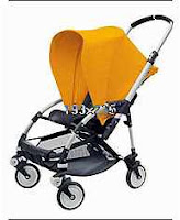
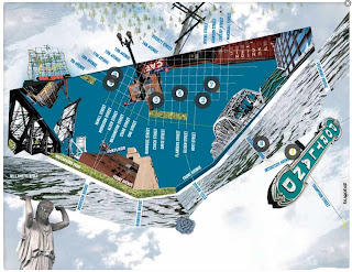
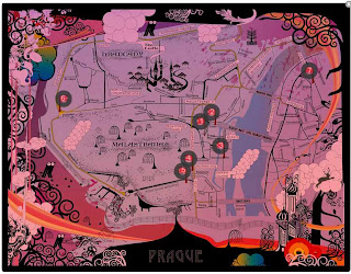
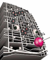
Here's a delightfully odd marketing strategy. Bugaboo strollers (right) has enlisted some avant-garde artists to make a series of day trip maps for cities in Europe, North America and Australia. They have points of interest you can click on to get more info. Apparently "third world" places such as Asia, Africa and Philadelphia don't rate with them.

One of the more interesting ones is Mina Monnee's Portland. I especially like how she wrapped the river around it.


I also like Prague by Dustin Arnold.

Robert Nakata has some of the most "artistic". Here are his renderings of Toronto and Brighton (England)

Thursday, August 28, 2008

Map of the Week-Children are Colorful and Beauty

Every couple of years the International Cartographic Association organizes the Barbara Petchenik International World Map Design Competition for children 15 and younger. Entries are archived online by the Carleton University Library in Ottawa, Canada. You can see all kinds of fun maps on this page. Many of them are cliched and similar looking but there's also lots of clever ideas in these young minds.

This entry is entitled "The world is colorful and beauty" and was done by Ferina Tjahyana from the Pelita Harapan Junior High School in Tangerang, Indonesia. She was 13 at the time this map was done (2003).