Showing posts with label seattle. Show all posts

Wednesday, October 7, 2020

Of Maps and Manhole Covers

One of my first posts featured this map on a Seattle Manhole cover. 

Since then I have been exposed to a world of manhole enthusiasts and found various other cool map examples. An entire blog post on this subject, complete with video can be found on Geography Realm.

Here is Oklahoma City, via Kontraband. The dot shows you where you are. There is a bonus state map at the top!

Chandigarh, India, a manhole possibly designed by Le Corbusier - via The Indian Express

Duluth, Minnesota with a dot pattern for Lake Superior- via flickr

Galicia - not a whole lot of detail here.

Over in Japan, colorful manhole covers are popular,

in fact so popular that there are sets of collectible cards. These cards have pictures as well as their gepographic coordinates so you can find them.

Here is a nice map, via guidable showing the locations of some of these cards. I'd like to be able to say more about this map but I don't know the language.

(Reference: Gesuido Koho Platform)

Wednesday, October 17, 2018

Ghastly Halloween Poster Maps

What, where, why? It all started with a software tutorial using data from upstate New York. GIS software packages tend to open with random color schemes. When I brought the data into GlobalMapper, it gave a nice orange and black Halloween palette - the orange below got browned a bit when by Twitter.

Looking around the area I decided that the Syracuse street pattern provided nice, creepy look for a Halloween poster - I will put some boring technical details about the process for these at the bottom so you can skip that part if not your thing.

Next, I thought about spider webs and looked for a city with a nice, webby street (or highway) pattern. San Antonio works-when looking at the regional highway network.
Here's a final one - another S city inspired by my childhood skeleton costume.
Enjoy!

Technical details:
Each map was done using a very different process. For Syracuse I downloaded data from OpenStreetMap, styled it in QGIS using a fiery pattern, then exported an image which I altered using a ridiculous combination of GIMP, Inkscape and Photoshop. If I knew those packages better I could have surely done all that in one but I used the bits and pieces I know from each. I used an online font generator for the title and then styled and altered it a bit in Inkscape.

For San Antonio, instead of downloading the data, I made a screen shot from OpenStreetMap and then used Photoshop to select and remove certain colors, then manipulated it in Inkscape with various spider web pattern fills.

Seattle was mostly done in Photoshop by manipulating layers and tracing the major roads from a screen shot with bones. The background is a knee x-ray image that I smudged to fill in the non-knee-like areas of the city like West Seattle and Magnolia.

Wednesday, May 10, 2017

Seattle Awareness Map

In 1978 the Seattle Department of Community Development published this map to raise awareness of the city's cultural landmarks.
https://www.flickr.com/photos/seattlemunicipalarchives/2572719557/in/photostream/
Seattle Municipal Archives posted a scanned copy on their Flickr site. The cover is a nice grouping of buildings, statues and ferries.
https://www.flickr.com/photos/seattlemunicipalarchives/2572719557/in/photostream/
Inside the map is densely populated with landmarks and yellow descriptive text bubbles,
https://www.flickr.com/photos/seattlemunicipalarchives/2572719673/in/photostream/
sometimes with additional info or commentary added.
 Some more detailed scans can be found on Rob Ketcherside's Flickr pages.
https://www.flickr.com/photos/tigerzombie/5076442361/
One final view-because I briefly lived near the Arboretum Gate House

Wednesday, September 7, 2016

The Seven Hills of Everywhere

Rome was built on seven hills. Here they are (the ones inside the city walls):
http://octavianchronicles.com/wp-content/uploads/2014/11/RomeColor730rev7.jpg

Many other cities decided that they wanted a piece of Rome's glory and created their own seven hills legends. Here is Wikipedia's extensive list of cities claiming to have seven hills. Of course the nature of hills make it easy to cherry pick various topographical features to come up with seven hills, and also to dispute those claims. Cincinnati seems like a good example of a city that's trying too hard to arrive at exactly seven hills.
http://www.diggingcincinnati.com/2014/03/cincinnati-city-of-seven-hills.html
Also cities tend to expand to include more hills and many of the original ones have been leveled. Here is a collection of various seven hills maps for your reading pleasure.

Jerusalem - they had seven hills long before Rome. Here is a sketch showing seven hills within the old (third) city wall 
http://www.centuryone.com/images/exploredjerusalem.jpg


One of the first cities to jump on the seven hills bandwagon was Constantinople (Istanbul) - here is a map from the Hebrew wikipedia. The hills are numbered but not named.
https://commons.wikimedia.org/wiki/File:Seven_hills_of_IST.png

Rome, Georgia - if you're going to name your city Rome, it might as well have seven hills.
https://en.wikipedia.org/wiki/Rome,_Georgia#/media/File:Rome_Georgia%27s_7_Hills_and_3_Rivers.png


Richmond, Virginia took the extra step of listing their seven hills in a 1937 ordinance. The goofy colored triangles represent "official" hills. Several other gray triangles shown are "unofficial" hills. The far west hill is called "Oregon" because that's how far west it seemed to the rest of the city at the time. The complete list is here. You can explore them interactively here.
http://www.rvabusiness.com/2012/06/28/the-seven-hills-of-richmond/


St. Paul, Minnesota - they can only agree on five of them, and some of them are really just bluffs rising up from the river. A full accounting of them can be found here.
https://www.minnpost.com/stroll/2015/07/st-pauls-7-hills-there-seems-be-agreement-5-them

Here is a nice map and description of Seattle's seven hills...
http://geologywriter.com/blog/seven-hills-of-seattle/
... except maybe there are really twelve?
http://geologywriter.com/wp-content/uploads/2014/10/Screen-shot-2014-10-20-at-6.01.07-PM.png

In Africa, Yaoundé, the capital of Cameroon is known as La Ville aux Sept Collines (city of seven hills)  - all of them are on the west side of the city.
http://www.memoireonline.com/01/13/6854/Anthropisation-et-risques-environnementaux-sur-les-collines-de-Yaounde16.png

Thiruvananthapuram-capital of Kerala Province India
Maybe not. The Hindu (souurce for this graphic) says "if we start counting the hills in the city, it becomes confusing. Hills there are, but to decide on the seven that the city rests on, is near impossible. The really high hills are outside the city."

Near me Somerville, Massachusetts claims seven hills and has a park devoted to them with cute towers marked for each hill.
https://summerinsomerville.wordpress.com/tag/seven-hills/
I was unable to find a good map of the seven hills so I made my own hand drawn one. Enjoy!

Wednesday, January 20, 2016

Apple Maps in 3D

The much maligned Apple Maps has improved its product in many ways. I bought a new computer for the first time in many years so I'm just discovering this not very new feature-the 3D models. They are accompanied by flyover tours of selected cities such as Seattle.

Apple acquired a Swedish company called C3 Technologies, that created 3D models of buildings based on aerial flyovers and guided missile technology. They were then able to quickly create a huge database of building models worldwide. Having tried to do this in SketchUp, (which I believe Google uses for their 3D buildings,) I have an appreciation for how much work each building takes. Unfortunately Apple's maps are only available on Apple devices. Google Maps has more extensive 3D coverage (and available to everyone with a web browser) but Apple's models are clearer and cooler looking. They also draw more smoothly.

Some gimmicks have been added. For example, In London Big Ben will always show the correct time, though it would be more accurate if it was lit up when it's dark there. Also, the London Eye is animated! 
Some more examples:
Sydney
Mount Rushmore
The Bromo Seltzer Tower in Baltimore
Here is a comparison of Google's vs Apple's 3D view of the above tower. Google's model is on the left.
Most articles online about Apple Maps are full of snooty comments about how bad they are. Google still has the edge over Apple Maps in many respects and StreetView is a huge reason to continue using them. However, in recent travels I've found Apple Maps more helpful for locating restaurants, hotels and other businesses. I use both of them (as well as Here Maps and even Mapquest) and do not strongly advocate one over the other but Apple Maps is definitely worth another look.

Wednesday, March 26, 2014

March Hot Dog Madness

Several years ago I featured the West Virginia Slaw Mapping Project, showing the regional pattern of hot dog preferences. As an update, the West Virginia Hot Dog Blog claims to have won last years National Hot Dog and Sausage Council March Madness style regional hot dog tournament.
http://wvhotdogs.com/slawbig.html
I will give them the benefit of the doubt but I could not find the above image or a winner listed on the Council's facebook page. They did make the final against the Coney dog. I used MapBox to create some geographical context for the contestants:

New York - As far as I can tell New York hot dogs are pretty ordinary but since New Yorkers think everything that comes from their city is special, it had to be on the list.


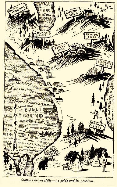
 Seattle - I don't know this for sure but I think this is a hot dog with cream cheese. They put cream cheese on everything up there. No wonder they lost in the first round.


     The famous West Virginia Dog. It is a "heavenly creation" that is topped with onions, hot sauce and usually cole slaw, though as the slaw mapping project shows, not in every county.


Georgia - I don't know this one but Delish, my source for this and the
Sonoran and KC dogs, describes an "Atlanta" dog. It's a hot dog with cole slaw. Sounds like they're copying West Virginia who they lost to in the first round. Nice Atlanta Flames logo in the poster =>


The Coney - This bit of geographical confusion is actually a Michigan thing. If you go to West Lafayette Boulevard in Detroit you will find a Coney Mecca of sorts. I know this is true because I've seen it with my own TV. The Coney (Coney Island style?) is slathered with chili, onions, mustard and cheese.


The Sonoran is a southwestern inspired dog from Arizona. The dog is wrapped in bacon and has jalapenos and pinto beans among other stuff. I've never had one but it has possibilities.


The Kansas City is a Reuben sandwich hot dog topped with caraway seeds to mimic the rye bread. Supposedly these are served at Royals games though I went to that stadium several times in the 1990s and never saw such a thing - maybe it had not been invented way back in the days of yore.


The Chicago dog. Basically you empty the contents of your refrigerator onto a hot dog. I had one of these at O'Hare airport. When I saw someone I knew from Chicago I asked whether the airport experience counted. After telling him the brand of meat served on the dog he assured me I had the real deal.


Oops, they forgot to include the famous Rochester White Hot and probably many other deserving regional varieties.

Wednesday, July 3, 2013

Yelp's Word Map

The Yelp Wordmap has been making the rounds on numerous websites. There is a common spin about seeing "where the hipsters live" but there's much more to it than that. The map allows you to pick one of 14 cities and a number of search terms that appear in restaurant reviews. For example, the default choice; "hipster" in San Francisco.
The term "noodles" gives you a good sense of where the Asian restaurants are such as in Seatlle's "International District" just south of the original skid row - now Yesler Way.
Many of the search words are the same but a few are customized for the city represented such as hoagies in Philadelphia. The biggest cluster is in the Italian Market area of South Philly but there are lots of other hoagie enclaves. Hoagies are traditionally associated with Italian-American culture and those settlement patterns are reflected here.
Unfortunately Yelp's information does not go far enough out from the city center to include the Tacony Hoagie Trail but this map will guide you there.

For a European perspective there are the brasseries of Paris. There is not really much of a pattern here because just about every neighborhood has its own brasseries.
Choose a city and explore - or (depending on where you're from) be annoyed that Austin made the list while your much larger city didn't.