Showing posts with label lake tahoe. Show all posts

Wednesday, October 27, 2021

More Cross Stitch Maps

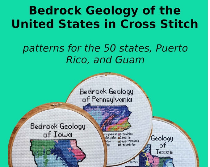
 One of the talks I enjoyed at this month's North American Cartographic Information Society Conference was from Kara Prior, who uses maps to create cross stitch pattern designs - on sale on her Etsy shop.

She details the process in her talk - now available on YouTube. The idea is to take a map and make it as low resolution as possible while still conveying information. That way you see the individual squares. Here is a screen shot from the video illustrating this.

One of my favorites is the bedrock geology of Arizona. The colors really jump out - some of them look like they were taken from the state's flag.

 
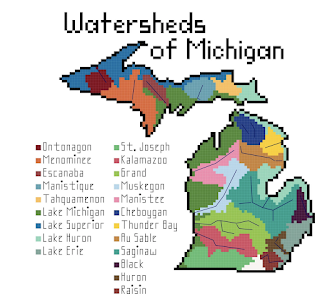
She also has bathymetry and watersheds as well as several other, non-map patterns. The watersheds can be quite simple such as New Jersey,

or much more complicated.

I'll end with some bathymetry examples


Wednesday, November 27, 2013

Wooden Bathymetry

Below the Boat sells wooden charts made by laser cutting contour lines from bathymetric charts. They feature maps of various coastal areas and lakes such as Lake Tahoe,
http://www.belowtheboat.com/products/lake-tahoe
http://www.belowtheboat.com/products/san-juan-islands 
http://www.belowtheboat.com/products/straits-of-mackinac
http://www.belowtheboat.com/products/virgin-islands
and many more. Explore their gallery and you'll see lots of pictures of cute pets posing with their maps.

Tuesday, March 13, 2012

Map of the Week-Burning Edition

Robert Ayres who created the burning Ponderosa map for Bonanza died recently.

This map is on permanent display at the Autry National Center in Los Angeles. Assuming that north is supposed to be up, the map was drawn incorrectly. When Ayres showed the map to series creator David Dortort he said "I love it, but your directions are wrong." Ayres fixed this by adding a compass with north pointing to the left and up. If only all cartographic problems could be solved this way.

Here's the map in action

For your viewing pleasure, here is the intro so you can watch it burn!


Thanks to my wife for the post suggestion and title.

Friday, September 14, 2007

MOTW #91 - Lake Tahoe Fire Risks

The Sacramento Bee had an article this past summer with a nice map illustrating how much building is going on in high risk areas for forest fires. The red are areas of high fire risk and the black dots represent building permit locations.