Showing posts with label great lakes. Show all posts

Wednesday, October 27, 2021

More Cross Stitch Maps

 One of the talks I enjoyed at this month's North American Cartographic Information Society Conference was from Kara Prior, who uses maps to create cross stitch pattern designs - on sale on her Etsy shop.
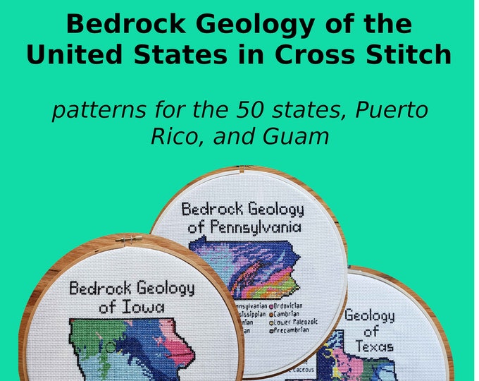
She details the process in her talk - now available on YouTube. The idea is to take a map and make it as low resolution as possible while still conveying information. That way you see the individual squares. Here is a screen shot from the video illustrating this.

One of my favorites is the bedrock geology of Arizona. The colors really jump out - some of them look like they were taken from the state's flag.

 
She also has bathymetry and watersheds as well as several other, non-map patterns. The watersheds can be quite simple such as New Jersey,

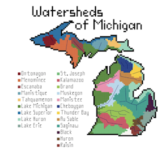
or much more complicated.

I'll end with some bathymetry examples


Wednesday, August 25, 2021

Michigan Map Mania

 Maps are ubiquitous but I've never seen so many as on my recent trip to northern Michigan. They love their state's shape. It appears on everything (with or without the Upper Peninsula) from jewelry to buses to chairs

to lamps

to the obvious oven mitt.

There is even a Handmap Brewing Company.

Arriving at the airport in Traverse City you see these nice artistic map tiles of the surrounding bays and peninsulas on the bathroom walls.

The stores are full of map-centric merchandise. Here is a shelf of coasters at My Secret Stash.

Here are a couple of map themed glasses.

I bought this Tolkien themed shirt there.

The company TeeSeeTee -nice logo! -
has all kinds of great map themes including Dr. Suess,

and PacMan.

Another store. Momentum Outfitters has an impressive collection of woodcut maps of seemingly every lake, bay and island within a 500-mile radius. The underwater depths are kind of fascinating - to me anyway.

They also have these nautical chart bags.


There were many good maps along the way including this in the Mission Point Lighthouse,

and this nice map showing the past and present of Glen Haven in the Sleeping Bear Dunes National Seashore.

Part of this larger sign.

Even the ice cream place (Moomers) has maps you can pin.
One of my final stops was at 45th Parallel Park in Sutton's Bay, just for the geographic novelty of it.


Wednesday, July 18, 2018

Comparative Lakes and Seas

Here's a beauty from the David Rumsey Map Collection. Comparing lakes and seas all at a uniform scale.
https://purl.stanford.edu/fh689md1694
The full title of this map is "Comparative Form and Extent of the Inland Seas and Lakes of the Globe" followed by the text "Drawn to uniform scale with indications of the nature and country in which they are situated." There are four panels, one for each continent (Australia was not included).
Lakes are placed where they fit on the page and are only arranged geographically if they are connected or otherwise grouped such as the Great Lakes or the lakes of central Manitoba-which are clearly not south of Chicago.
Here is part of Asia - the major seas are arranged geographically while the rest of the lakes are fitted in where space (land) allows.
 Published in 1852 by William Blackwood & Sons of Edinburgh and London, it is Plate 3 from the Atlas of Physical Geography, Illustrating, In a Series of Original Designs, The Elementary Facts of Geology, Hydrology, Meteorology and Natural History.  This atlas has some other gorgeous details such as this "chartography" from the frontispiece.


Wednesday, July 19, 2017

Message in a Bottle

This map appeared in my inbox a while back and now I can't seem to find any reference to it online.
If you put a message in a bottle, who will find it? The map is credited to the Weather Bureau of the USDA and shows "bottle paper courses" from 1892 and 1893. The legend is cut off but I think that the blue lines are from 1892 and the red from 1893. Either the weather bureau actually placed bottles and then retrieved them or this is just some theoretical map based on currents.

Almost all of the bottles travel eastward, with the flow of the St Lawrence Seaway. However the ones placed near shore in the Toronto area get caught in a counterflow that takes them to the west before heading south and then back to the east.

If anyone has additional information about this unusual map I'd love to know more.

Wednesday, September 2, 2015

Superior Wooden Bathymetry

Paul Meysembourg, a GIS lab manager at the University of Minnesota Duluth's Natural Resources Research Institute and one of my blog readers was inspired by the Wooden Bathymetry blog post to take his scroll saw and cut out Lake Superior.
He used GIS software to give it a high level of accuracy. In the words of the artist:
Being a GIS guy (about 24 years now, I was inspired to try and cut a much more accurate bathymetry map of Lake Superior since I live real close to it (Duluth, MN).   The ones I've seen are are very artistically done but "laughable" with regards to accuracy. Here's a picture of my just completed map. I massaged the DEM in ArcGIS and brought the individual layers into Photoshop to print them at actual cutting size.
Here's a colorized version.

More from the author
I jokingly will call this "My Old School, Green, Navigation Chart"  By the way, the actual dimensions are about 25w by 13h (the biggest I could get in my scroll saw).  Also, I stack cut them, so I have 2 more - I am going to donate one of them to my workplace to hang in the lobby and the other one I may try and sell, but I am not doing this for money.   Some details:  the frame is made from driftwood my son and I picked up last weekend from the shore in Superior, WI (there's a metric ton of it out there now after the big flood we had a few years ago).  There were about 40 island pieces (some really tiny ones) to cut and glue on for each one and I used seven layers of Birch plywood.  I left the guide paper on the top one before gluing it up but I actually prefer the look of the plain wood.
Last month (six months later) he gave me another update:
After that first attempt, even though I said I wasn't going to do another of Lake Superior,  I've completed another.  This time I stack cut 4 sheets at a time.  I also experimented with "pre-tinting" the whole sheets before cutting so the islands cut-out sections would be the same color.  I used water-based stain in increasingly darker shades.  I also upped the detail significantly since my scroll saw technique was much improved.  The problem with the increased detail was that now I had to keep track of about 90 island pieces (times 4) and then glue these pieces back into the correct location!  Some of these teeny pieces can easily get "vacuumed away" as I tried to keep the saw dust somewhat orderly.  It turns out this fine level of detail is making these more of art project instead of a woodworking project, in my opinion and I've never considered myself to be an artist.

Anyway, after all that work, they turned out rather nice.  I have since sold one that was hanging in a small local art gallery. I sold one on Etsy and I have one hanging in my family room and the remaining ones will probably be gifts.

I am planning on doing more, in the same fashion, but I just ordered a larger, hobbyist CNC router device and I am going to see if I can obtain the same detail level using fine router bits in solid slabs of wood. 

Thursday, November 7, 2013

The Great Lakes Storm of 1913

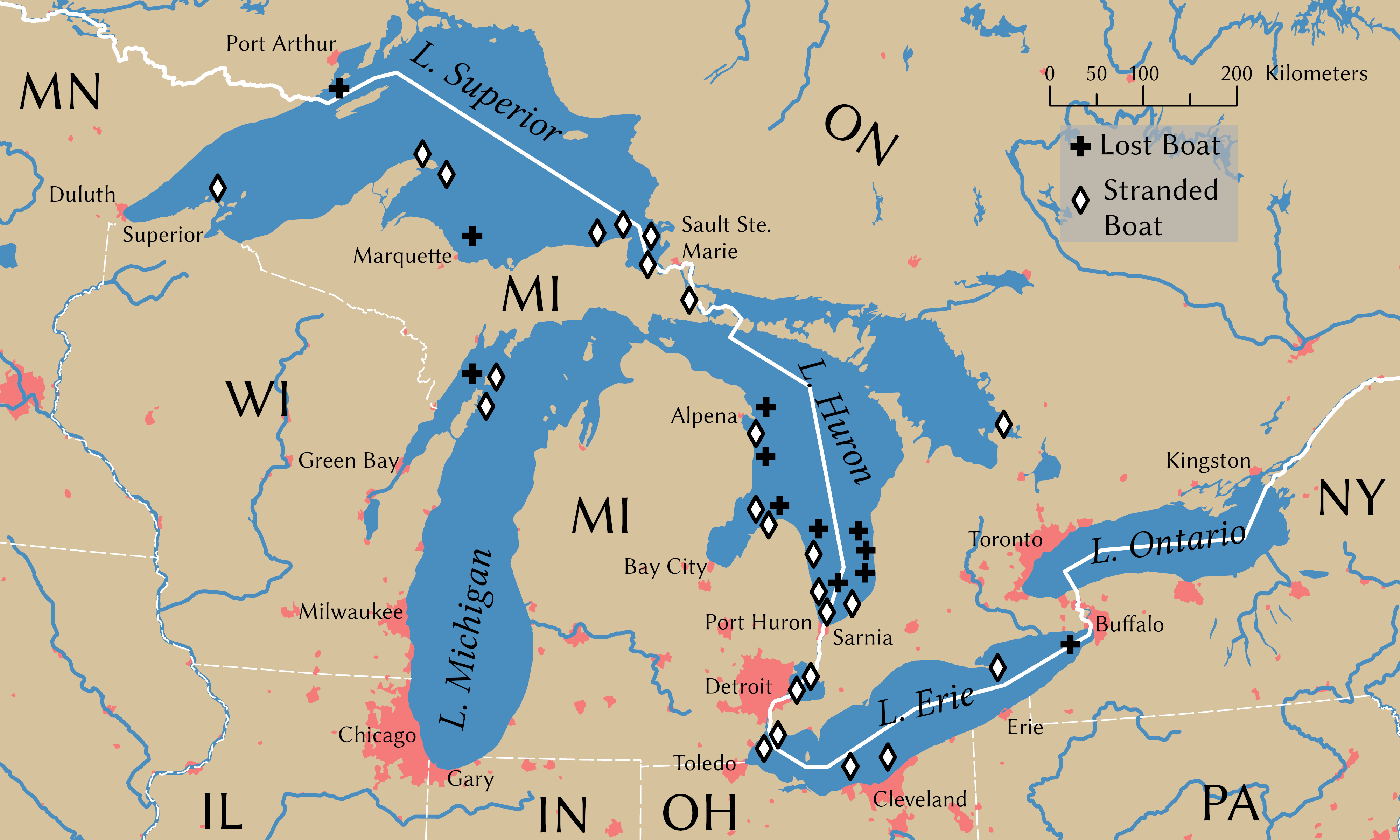
100 years ago today was the beginning of the Great Lakes Storm, the most deadly and destructive storm to ever hit the region. Also known as the "White Hurricane" because of the blinding snow that fell, the storm killed over 250 people, destroyed 19 ships and stranded 19 ships and some additional cargo barges. The storm raged for several days with a few lulls that only served to give false hope to stranded mariners. Most of the destruction occurred in Lake Huron. Wikipedia has this excellent map, originally from the USGS showing sunken ships in black and stranded ones in gray. Click for the original, more readable image.
The storm intensified and built up to hurricane force on November 9th. The US Weather Bureau only issued reports twice a day so most of this build up was not noted until too late. Cleveland saw 22 inches of snow and lost power for days as did much of the region. Breakwaters were destroyed in Chicago and Milwaukee.
   
There is a story on NPR's Morning Edition on the search for two ships in Lake Huron that have never been found. Another interesting account of the attempts by some crews to survive can be found in The Paragraph.

Wednesday, February 27, 2013

Paddle-to-the-Sea is on Google Earth!

 
A young Indian boy carves a little canoe with a figure inside and names him Paddle-to-the-Sea. Paddle's journey, in text and pictures, through the Great Lakes to the Atlantic Ocean provides an excellent geographic and historical picture of the region.
When I was in school one of the teachers showed us the movie version of Paddle-to-the-Sea. At first I thought it was kind of dumb watching a kid carve a canoe and I probably wasn't paying complete attention. Then suddenly, the canoe slid down the hill and into the river and began its journey. I was transfixed and transformed and all those other cliches. Ever since then the movie has had a powerful hold on my imagination, though not in the forefront of my mind until I found out that you can see it in Google Earth.

The COSEE Great Lakes web site allows you to download a kml file and explore it, chapter by chapter. Here are the beginning chapters from the Nipigon River region of Ontario.

Paddle the enters Lake Superior. After heading the wrong way and getting stranded on beaches and marshes, it eventually finds its way to the Soo Locks with the help of a dog sled.
After a detour through Lake Michigan, it ends up in the lower Great Lakes where it tumbles over Niagara Falls and into the St Lawrence Seaway.
Finally reaching the Atlantic it gets caught by a French fishing boat and brought to France.
The book itself is worth re-reading or even purchasing. I took a nicely worn copy of it out of the library. Here is an image of the main map from the book taken from SecretPlans.

In addition to the geography lessons, the book also diagrams a sawmill, a canal lock, a lake freighter and several other industrial processes that take place in the Great Lakes region. It also has diagrams that morph the lakes into recognizable shapes long before morphing became fashionable. Lake Superior is morphed into a wolf's head, while Huron becomes a trapper carrying a pack of furs.The maps also show the birthplace of the Dionne Quintuplets - this must have been a big story for the pre-octomom era.