Showing posts with label san francisco. Show all posts

Friday, April 17, 2020

The San Francisco Model

The San Francisco Model has been digitally assembled by the David Rumsey Map Collection
The Map Collection page describes it as 

"a 42 by 38 foot wooden replica of the city of San Francisco as it was in 1940 in 158 pieces at a scale of 1 inch to 100 feet. The pieces contain about 6,000 removable city blocks. The model was built by The Works Progress Administration in the late 1930's, under the New Deal. It was first displayed in sections in the Golden Gate International Exposition on Treasure Island in San Francisco Bay in 1939. In 1940-1942 it was displayed in San Francisco City Hall. The model was used as an urban planning tool by San Francisco city agencies and departments through the 1960's. In 1968, the downtown portion of the model became a research and planning tool in the Environmental Simulation Laboratory in the College of Environmental Design at UC Berkeley. The model has not been on public view, in its entirety, since 1942. UC Berkeley is the current owner of the model. The intent of the makers of the model was to have it updated as the city changed over time and they conceived of it as a tool to help understand and plan for changes in the city's built environment."

The entire model can be browsed here. Here are some samples:

Alamo Square Park. To the right is Steiner Street where everybody in San Francisco lives according to Hollywood. I don't know if the painted Victorian houses were painted back in 1940 and the street looks notably less fashionable from this view.
The entrance to the Golden Gate Bridge, though the bridge is not shown.
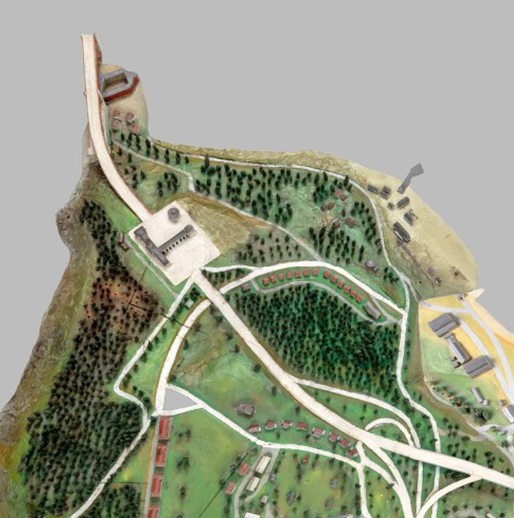
 A residential area in the south part of the city.
To see more go to their viewer page.

Wednesday, April 15, 2020

Joe Talbot's Frisconian Field Guide to San Francisco

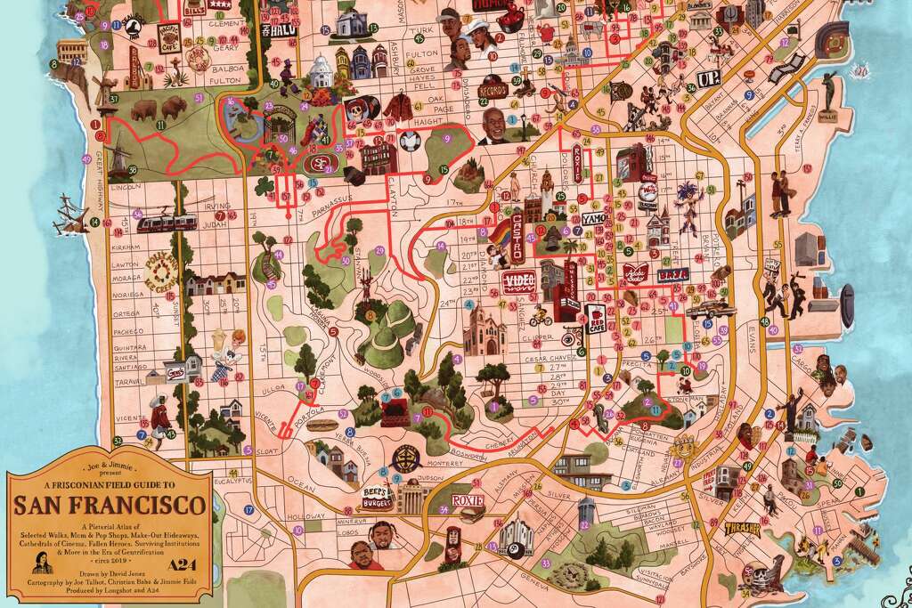
Joe Talbot, director of the Last Black Man in San Francisco, created this charming map - via SFGATE
https://s.hdnux.com/photos/01/10/26/04/18964755/3/1024x1024.jpg
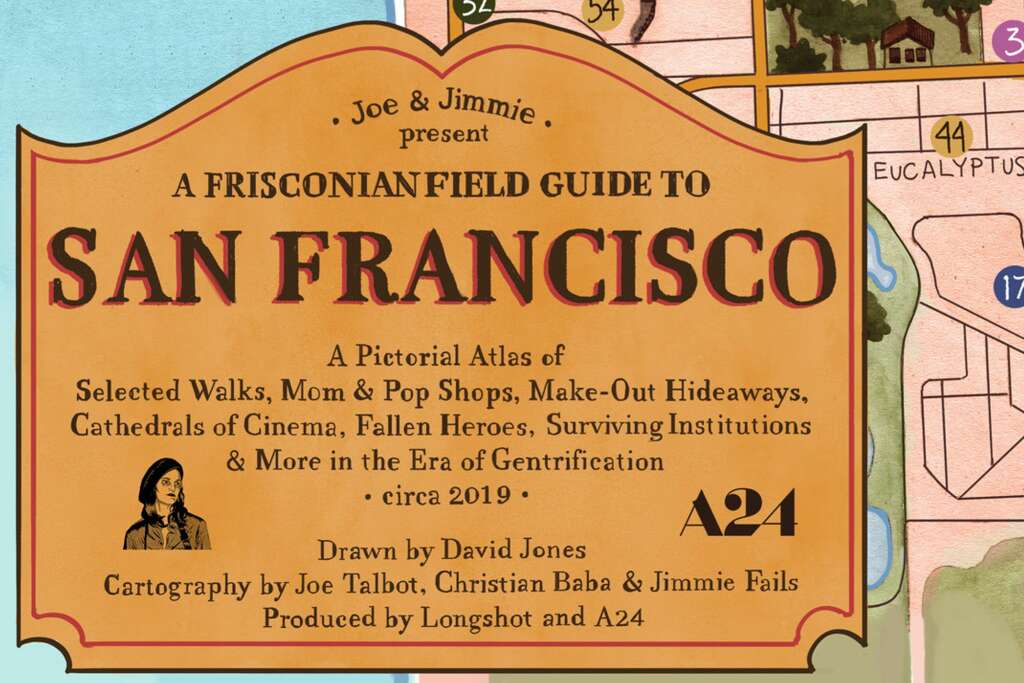
The idea was to capture what places have been priced out and what still exists. Here is the title block.
https://s.hdnux.com/photos/01/10/26/04/18964742/3/1024x1024.jpg
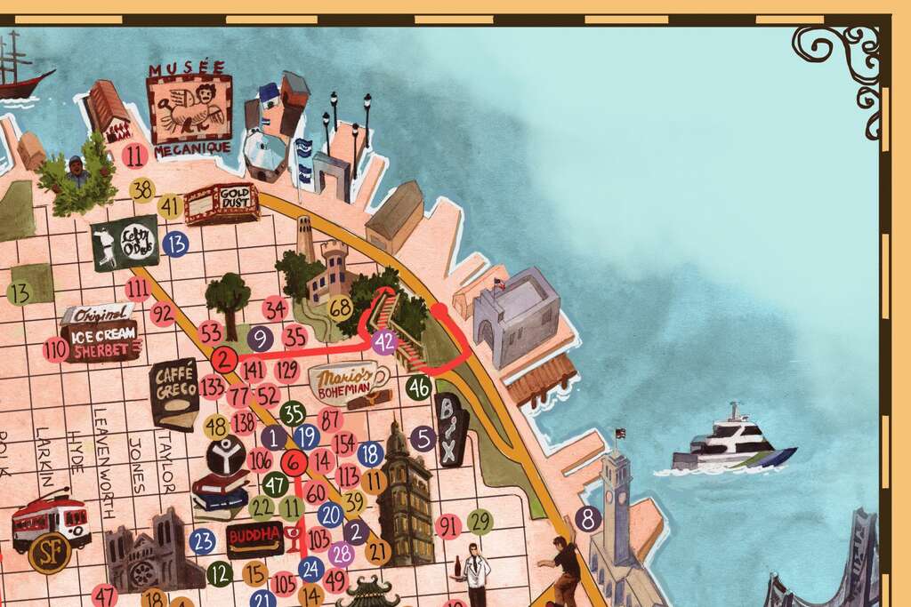
Here are some details.

https://s.hdnux.com/photos/01/10/26/04/18964743/3/1024x1024.jpg
Here lies the ghost of a football stadium as people in hazmat suits dump  green stuff into the bay.
All these pictures were lifted from SFGATE where you can read and see more details.

Monday, April 13, 2020

Chinatown San Francisco

Blog Note: This week is San Francisco week. A few years ago I did New Jersey week. Why? Because I had a lot of New Jersey stuff. Same reason now. Also Wednesday (415) is San Francisco day. There will be some bonus map posts here and additional content on Twitter.

This map grabbed my attention when I saw it at the Leventhal Map Center's America Transformed exhibition.
https://collections.leventhalmap.org/search/commonwealth:0r96fp62n
Chinatown is one of the oldest continually inhabited ethnic enclaves in America. The 1929 map is cool and also a bit disorienting. A map of a US city labeled in another language and script gives a new perspective.The map is also flipped with west at the top.
Chinese people came to California during the gold rush and worked on the railroads. They suffered significant discrimination but found safety in their own ethnic enclaves. Despite racist policies, the government was unable to remove them from the neighborhood.
I like the little arrow-bubble above which I'm told by a Chinese coworker merely says "San Francisco Chinatown". I also like the little trolleys. Here is a nice illustration of the ferry building,
and here are some ferry lines from a regional map in the corner of the page. This map is oriented with north at the top unlike the main map.
I assume this text is showing the property owners.
Here is the north arrow with the sun rising in the east.


Tuesday, June 11, 2019

Pictorial Maps from the La Jolla Map Museum

In one of my final posts from my March visit to the La Jolla Map & Atlas Museum, I will show some of their large collection of pictorial maps. They just opened a new room dedicated to these maps including many by Jo Mora, an artist and photographer originally from Uruguay who moved to California, the subject of many of his pictorial maps.
Photo taken at the La Jolla Map & Atlas Museum

Photo taken at the La Jolla Map & Atlas Museum
More on the map above can be found in a previous post.

Another popular collection of pictorial maps is the "Hysetrical Map" series by the Lindgren Borthers.
Photo taken at the La Jolla Map & Atlas Museum
This one is titled "A Hysterical Map Of The Mother Lode Where California Was Born and Hell Was Raised." It's full of jokey details such as "Gold is often found in sand but so is spinach" and "An ass covered with gold has more respect than a horse with a pack saddle." There are also maps of Yellowstone and the Grand Coulee Dam featured on the museum's web page.

A 1963 tourist map of southern California grandiosely titled "Ride the Roads to Romance along the Golden Coast thru the Sunshine Empire of Southern California" shows historic trails emanating out for Los Angeles City Hall,
Photo courtesy of the La Jolla Map & Atlas Museum
to charming mountains, orange groves and historic missions.
Photo courtesy of the La Jolla Map & Atlas Museum
The edges of the map show natural and historic vignettes.
Photo courtesy of the La Jolla Map & Atlas Museum
Harrison Godwin's 1927 map of San Francisco ("where the sun never scorches and the water never freezes") is one of the most detailed pictorials packed with facts, figures, "whimsical vignettes" and transportation info.
http://lajollamapmuseum.org/maps/map-san-francisco-showing-principal-streets-and-places-interest
I was not able to get a good up close photo but here is a screen shot via the David Rumsey Map Collection.
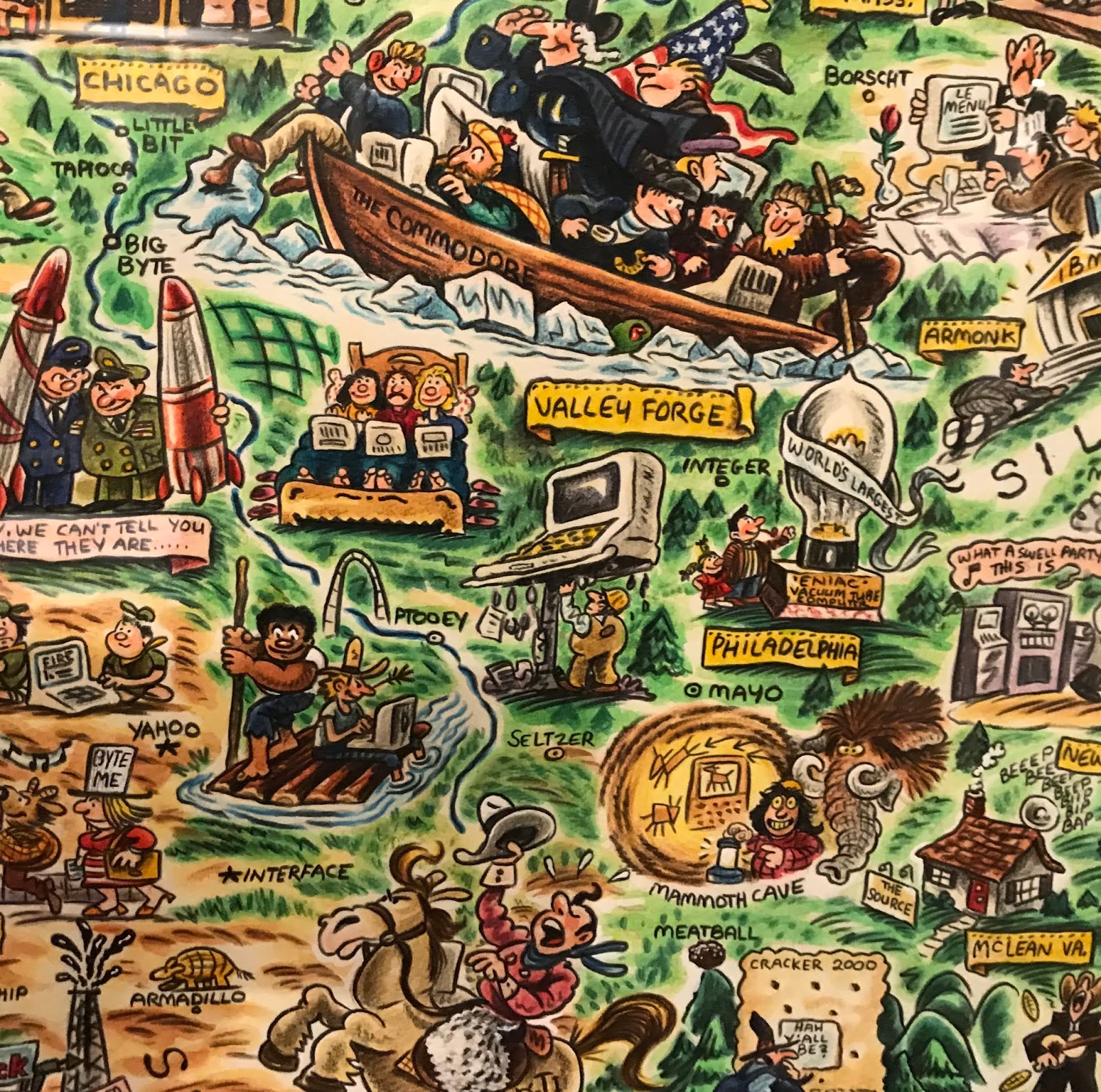
For a slightly more "modern" take here is the "Digital Deli Map of Personal Computer America" by illustrator Rick Meyerowitz, most famous for his work for National Lampoon. The map highlights Silicon Valley culture.
The bottom of the map contains a list of highlighted companies.
Highlights include a hiker in the Cascades carrying a large PC on his back with the screen reading "You are lost" and people in hot tubs looking at their computers. Here is part of the less important and therefore compressed eastern two thirds of the country.


Wednesday, February 7, 2018

More Map Acquisitions

Map Acquistions - Part Two

Central Leningrad from a city guide by Intourist,  travel service of the U.S.S.R, circa 1976.
Another view of Leningrad, Falk plans, Hamburg, Germany, 1976.
A very schematic map of Moscow from Intourist.
Tourist map of Milan - the eye watering color scheme and overly fussy level of detail make it a treat to try and read.
Bus guide-Barnet, North London
A "Parking Disc" for North Yorkshire - set the time of arrival and display on your windscreen. Fail to display the disc and you have "committed an offence."
Hughes Airwest map of Guadalajara,
and Puerto Vallarta
Here's something I haven't come across before - an uncredited map. There is no publishing info but here's the cover.
There are some nice details on it,
 with this odd inset - I guess showing the extent of streets in 1947. Except where they masked them under "San Francisco"
Finally, a personal favorite since I vacation here, "Damariscotta Boxes the Compass" a map with a ridiculously prominent compass.

The houses and churches are drawn so large you can't tell where they're located. This is from the Damariscotta Information Bureau - we still use their maps but they are much more legible these days.

Wednesday, April 5, 2017

Grand Theft Auto

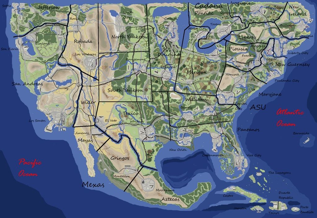
I'm not much of a video game player so my ignorance of these things will be pretty obvious to the average gamer. Many video games have cool maps. What's interesting about the geography of Grand Theft Auto is that it is only sort of fictional - the names are different but the places are obviously recognizable. Here is a user created map of San Andreas created by Brazilian user DaniLekBom.
http://gtaforums.com/topic/447751-gta-mapmaking/page-124#entry1069187250
Names like "San Joan" and "Oakplace" are pretty thinly disguised. I like how he squeezed "San Donado" down at the bottom. You can just about see where the ESRI user conference takes place.

There's also a city in the desert. It's called Las Venturas. It has a strip! What was that inspired by? A couple of mysterious places inland like Endsville, Grapeseed and Coconut Springs have less obvious corollaries.

Vice City is another common locale in the game. Sometimes referred to as Vice-Dade County as if it wasn't obvious enough where it is.
http://i.imgur.com/iP2ZiDa.png
Liberty City is also a very familiar looking place. Here's a nice map of it. Lots of green spaces - including a largely empty "Staunton Island."
http://i.imgur.com/6DBJHwZh.jpg
A close-up detail...


Here is the entire United States GTA'ed.
http://i1368.photobucket.com/albums/ag179/gtafan555/gta_america_map3_zpsssl6usgk.jpg
I like how the Dakotas are renamed North and South Yankton and New Jersey becomes New Guernsey.

You can find these, and many more maps, including Europe, Asia and Africa on the GTA Mapmaking Forum.
http://s1368.photobucket.com/user/gtafan555/media/gta_africa_1.9_zpssmpsuimj.jpg.html

NOTE: This is not an endorsement of a violent, sexist video game that may encourage crime and DUI (I don't know, I've never played.)  I'm only here for the maps.

Thursday, December 15, 2016

Ships Under San Francisco

A recent post on BoingBoing (via FoundSF) shows this map of ships buried under San Francisco's streets.
https://i1.wp.com/media.boingboing.net/wp-content/uploads/2016/12/ron-filion-01.jpg?w=1977
The area that is now the Financial District was once Yerba Buena Cove, a busy harbor teeming with ships during the Gold Rush. Many of were abandoned as the harbor began to be filled in. Recent construction projects have uncovered some of these ships. Here is an 1851 map from the FoundSF page showing the harbor being filled in. The original coastline is depicted as well as the old wharves.
http://www.foundsf.org/index.php?title=File:Downtwn1$1851-cove-map-closeup.jpg
The original map is from 2000 by Roy Fillon. FoundSF does not give details about the source for Fillon's map but they do show a nice, retro-looking adaptation of the map by Sam Manera.
http://www.foundsf.org/index.php?title=Ships_under_Financial_District
The FoundSF article includes links to pages about two of the ships that were converted to other uses, one as a hotel and another as a jail.
http://www.foundsf.org/index.php?title=File:Aframer1$niantic.jpg