Showing posts with label nepal. Show all posts

Thursday, July 26, 2018

Comparative Mountains and Rivers

Continuing last week's theme of comparative maps, here are a few examples of a genre of map that compares mountain heights and river lengths.
https://www.davidrumsey.com/luna/servlet/s/0ixpy8
This map was originally published by Henry Tanner (1836) and modified by S, Augustus Mitchell (1846), both of Philadelphia.  Like last week's map, the geography is arranged to fit the space with the shortest rivers cleverly positioned atop the tallest mountains.

The peaks are numbered. On this and the other maps from this period the highest known peak was Dhaulagiri in the Himalayas, now the seventh highest. In addition to mountains, the heights of cities and lakes are shown. Below Quito, Ecuador is shown beneath Pambamarca.

Down at the bottom are some of the Pyramids of Egypt, the "Falls of Niagara" and lakes such as Ontario (42), Erie (36) and Superioir (32). Above that is Caracas and the limit (this is a guess) of where bananas grow. Also along the bottom are various cities and landmakes such as the mines of Huancavilica and the Philadelphia Shot Tower. More of this map can be seen on the David Rumsey Map Collection page here.

Here are a couple more variations on this theme You can click them to see enlarged views from the Rumsey collection. This one published in London by William Darton in 1823 has everything arranged on one side.
https://www.davidrumsey.com/luna/servlet/s/0c039n
I like the treatment of the rivers here.
This one (Joseph Thomas, London, 1835) has the rivers at the bottom and the mountains in several rows.
https://www.davidrumsey.com/luna/servlet/s/9s1h69
Finally, for a local view, here are the rivers of Scotland.
https://www.davidrumsey.com/luna/servlet/s/9w9pif

Many more examples of this theme can be seen on this excellent blog post from the Rumsey collection.

Wednesday, May 27, 2015

The World Blueprinted

Philadelphia Data Scientist Lauren Ancona has created a blueprint map of the world. Mapbox enables you to create and cover the world in a style. In Philadelphia, she added extra details from city's open data site.
When you reach the city's edge the level of detail drops off a bit.
However, because Mapbox uses OpenStreetMap data, you can go anywhere. There's a remarkable level of detail in most urban areas. For example, Rio De Janeiro.
 
Kathmandu has seen a great increase in mapping detail thanks to the Humanitarian OpenStreetMap Team. Importantly, you can see where the Baskin Robbins is.
 
The lack of detail in many places makes it tough for wayfinding. I could not clearly find the place I helped map in Nepal a few weeks ago but it is  somewhere around here.
Of course, it looks nice when you're zoomed way out too!


Wednesday, April 29, 2015

Humanitarian Open Street Map

The Nepal Earthquake has caused tremendous destruction. The Humanitarian OpenStreetMap Team (HOT) has been responding to these kinds of emergencies for several years now. They are recruiting volunteer mappers to improve maps in the affected areas to help disaster response. There is a small learning curve and the instructions are a bit vague in places, but anyone with basic computer skills can help out, including me. Here is some work I did yesterday in a valley east of Chautara, about 25-30 miles from Kathmandu.
I added buildings and paths to the map based on low resolution aerial photos from Bing.
To get an idea of how spotty the mapping is in this area, here is a map of a nearby quadrant. There are lots of houses and other buildings but many of them have no known road access. The dashed lines are listed as foot paths. There is probably motor vehicle access along these paths and along other routes that are not apparent from the aerial photos but the only known "road" on this map is the red line in the bottom right corner.
While mapping is still very incomplete in the area, you can see how much detail has been added to OpenStreetMap, when compared to Google Maps (right side below.)
Comparing a more urban area gives you a better picture of the detail that has been added to OpenStreetMap - this is near Tinchuli, just northeast of Kathmandu.

The rural area above was specified as a priority when I logged in. When you begin, they present you with a map showing which areas need work and where the priorities are. The areas are divided into grids and you can pick one or let them assign you a grid to work on. The unshaded areas are the ones that need work. This image is for a second pass-the first pass was mapped a few days ago.

In fact, mapping of Nepal has been ongoing for a couple of years now. The HOT anticipated this kind of emergency two years ago and had a mapping party - complete with a nice cake!.
Here is a quote from the project page, February, 2013.


Recently, several reports have warned that this spectacular nation is at high risks from earthquakes. According to Nepal Risk Reduction Consortium Secretariat, a mega-earthquake—which could occur at any time—is estimated to kill more than 100,000 in the Kathmandu Valley alone, injuring another 300,000 and displacing up to 1 million.
If anyone in the Washington D.C. area is interested there is a three day mapping summit there starting tomorrow (April 30th.) Hopefully someone makes them a nice cake - they deserve it!

Wednesday, January 28, 2015

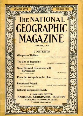
100 Years of National Geographic Maps

 In 1915 National Geographic created a new cartographic division, now known as National Geographic Maps.
http://en.wikipedia.org/wiki/National_Geographic_%28magazine%29#mediaviewer/File:1915NatGeog.jpg
A century's worth of highlights and challenges are detailed in Cathy Newman's article 100 Years of National Geographic Maps.  From Newman:
At this writing (the count is obsolete as soon as it is tallied), National Geographic cartographers have produced 438 supplement maps, ten world atlases, dozens of globes, about 3,000 maps for the magazine, and many maps in digital form.
Their first cartographer, Albert M. Bumstead invented a sun compass* and the Bumstead photocomposing machine that replaced hand lettering with photographic type. An example of some of their innovative approaches is this gorgeous map of the Himalayas, taken from a combination of high resolution photography from the Space Shuttle Columbia and aerial photography
http://news-beta.nationalgeographic.com/2015/01/150123-maps-mapping-cartography-history-national-geographic-centennial/
They were also the first to map both sides of the moon, including the side that is hidden from the earth.
http://news-beta.nationalgeographic.com/2015/01/150123-maps-mapping-cartography-history-national-geographic-centennial/
Here is a map showing many of Ukraine's place names that needed to be changed after the collapse of the Soviet Union in 1991.
http://news-beta.nationalgeographic.com/2015/01/150123-maps-mapping-cartography-history-national-geographic-centennial/

See the article for more maps and details about the past and future of National Geographic cartography.

* the sun compass was a type of watch with a pin that cast a shadow that when inclined at the correct angle would indicate which way was north based on the time and latitude. It was used by Admiral Byrd on his first flight over the South Pole in 1929.