Showing posts with label military. Show all posts

Wednesday, January 11, 2017

Mem-O-Maps

John G. Drury (1907-1988) created a series of "Mem-O-Maps" for World War II soldiers. To kill time on the ship returning from the Pacific he used his experience with Army charts to draw maps of Japan with scenes known to GI's. The map featured bright colors, amusing images and optimistically removed all sense of devastation.
http://www.barronmaps.com/the-mem-o-maps-of-john-g-drury-1945-46/

Fellow soldiers asked for their own copies. By the time they landed ashore he had sold 232 copies* of these maps and came home with an idea to turn this into a business. The legend had blank spaces with instructions on how a soldier could customize the map with their own details.
He created maps for Japan, Korea, the Philippines, Hawaii and Europe. Some details from the Europe map include someone pissing on Germany,
and this detail of Paris showing a naked woman symbolizing the La Roulotte night club along with a pig next to an alley referencing the Pigalle neighborhood where the club was located.
*These images and information are all from Barron Maps. For more maps and much more detail about Drury and his company see their blog.


Saturday, July 6, 2013

Gettysburg Anniversary

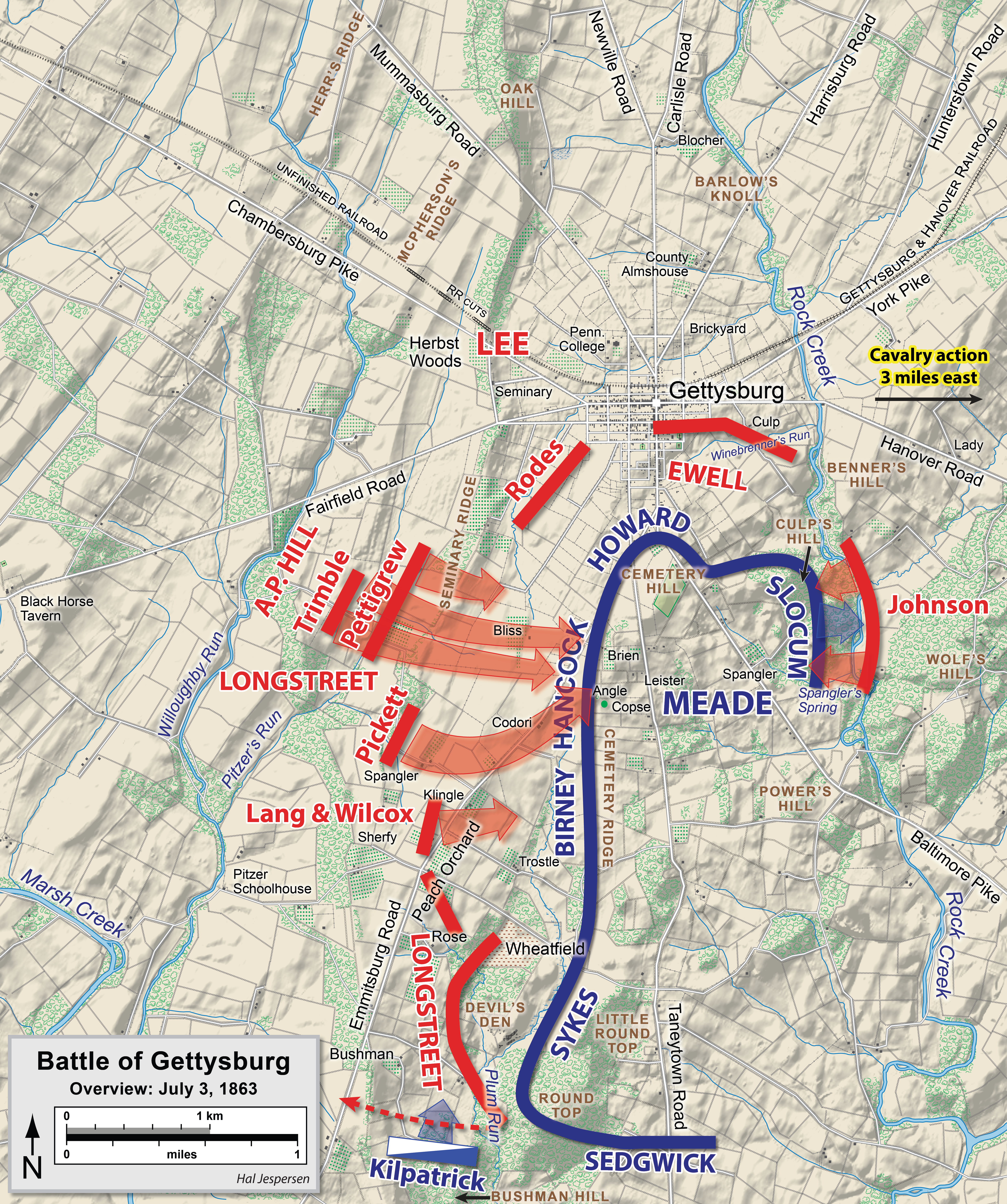
This past week was the 150th anniversary of the Battle of Gettysburg. I know this from a commemorative glass I bought at a garage sale in Albany about 25 years ago.
The glass shows the third and final day of the battle with Pickett's Charge prominently featured. A little cranberry juice really brings out the map's details.

For comparison, here is an annotated historical map from the Ken Burns Civil War film on the PBS website.
The higher level of context, accuracy and detail are nice but it doesn't have the same charm as my glass.  

Finally, the much more subtle wikipedia map.

Tuesday, November 24, 2009

Map of the Week- Lookout Mountain

On this day in 1863 Union and Confederate forces fought the Battle of Lookout Mountain. After losing a major battle at Chickamauga in September, Union forces gained control of this strategic overlook and the following day forced the Confederate troops off nearby Missionary Ridge. These battles enabled the Union Army to control most of Tennessee and set the stage for later campaigns in Georgia.


This battle and many others are nicely documented in maps for Wikipedia by amateur Civil War historian Hal Jesperson.


He also sells coffee mugs and t-shirts featuring his maps at Zazzle. Maybe someday he'll make a Lookout Mountain coffee mug that looks as nice as this one showing the Battle of Shiloh.

Thursday, April 16, 2009

Map of the Week-Patriot's Day Edition

Monday is Patriot's Day here in Massachusetts. We commemorate the first revolutionary war battles by taking a day off from work and re-enacting these battles. We also have related activities like a morning Red Sox game,  a marathon, drinking beer out of paper bags on the T and bragging about our "wicked awesome" sports teams.  Here is a map of the activities of April 19th, 1775 - some of it happened right down the street from me.  

Thanks to the Department of Military Science at Worcester Polytechnic Institute for the map. Their timeline of events (and this map) can be found here

Thursday, December 27, 2007

Map of the Week #105-A Geography of Chaos

We interrupt this season of peace and good cheer to bring you a map of the current turmoil in the Middle East. This map was done by Philippe Rekacewicz who does some nice cartography for Le Monde Diplomatique. The map is a companion piece to their November, 2007 "Special Dossier on the New 'Broader' Middle East" I had some more optimistic ideas but after today's events in Pakistan this one somehow seemed appropriate.

Thursday, December 14, 2006

MOTW #56

This is an animation showing the history of empires in the Middle East with a corresponding time line.

Thursday, November 10, 2005