


1 year ago
Friday, December 29, 2006
MOTW #58
In honor of New Year's Eve I had posted an interactive Guy Lombardo map of London, Ontario showing all the sites related to his life growing up there. There were lots of amusing and somewhat violent stories attached to the various places he lived and played music. Sadly, the map seems to have disappeared from cyberspace.
Thursday, December 21, 2006
MOTW #57

Vwmaps founded by Martin, one of our loyal readers produced this map showing all NPR stations in the USA.
0
comments
 Labels:
australia
,
radio
,
shameless commerce
,
USA

 Labels:
australia
,
radio
,
shameless commerce
,
USA

Thursday, December 14, 2006
MOTW #56
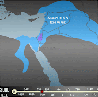
This is an animation showing the history of empires in the Middle East with a corresponding time line.
Labels:
history
,
international
,
middle east
,
military
Thursday, December 7, 2006
MOTW #55
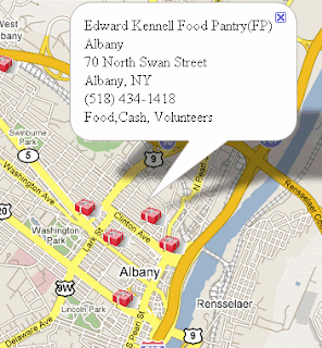
The Giving Map is a simple web-based application that identifies locations in New York's Capital District (aka Albany-Schenectady-Troy) where individuals can make donations of food, cash, clothing or their time this holiday season. While this is not a comprehensive list of all the giving opportunities available, it does provide the names, locations and contact information for many major charitable organizations in the Capital District.
Labels:
albany
,
christmas
,
new york state
Thursday, November 30, 2006
MOTW #54
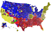
Pop vs. Soda - what do you think? The image below links to several interactive maps and a whole research study about who calls soft drinks which generic names in various regions of the country. Like the famous "mayonnaise line" there are distinctive lines between pop, soda and coke regions. Also note the odd outlying regions around St Louis and Milwaukee.
Labels:
cultural geography
,
language
,
USA
Thursday, November 16, 2006
MOTW #53
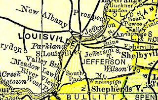
The Livingston County (Michigan) Historical and Genealogical Project has posted the entire USA section of Rand McNally's "New 11 x 14 Atlas of the World" from 1895. Click on the map and scroll down a ways (below the Pledge of Allegiance) to get to the list of states. Click the "button" underneath any state to get a state map or a map for any county in that state.
Subscribe to:
Posts (Atom)


