
This map was produced by the Automobile Club of Southern California in 1915. It shows a 60-mile round trip from Los Angeles to Topanga Canyon.
 Click to see it in higher resolution. Here is a detailed view if you don't feel like waiting for the image to load.
 There are lots of nice details, including hatch marks for the hills, generalized grids in the built up areas, and grade percentages listed in the canyon. The mileages are marked in circles going counterclockwise from downtown LA. Seems odd that they would send you in that direction (all left turns) but maybe left turns were not a big deal in 1915. Reverse-direction mileages are also listed.
The map gives a good indication of what areas were settled in 1915. In addition to the obvious missing freeways there are also numerous boulevards that had not yet been built like Sunset Boulevard, west of Hollywood. Nevada Avenue shown in Santa Monica is now an extension of Wilshire Boulevard.
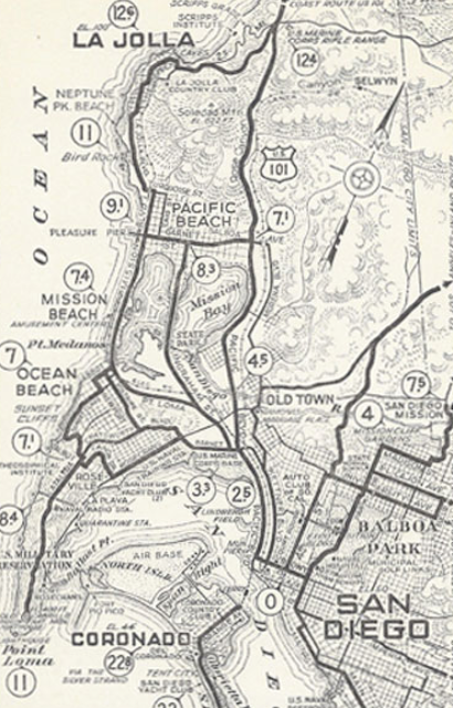
If you like this map, there's a treasure trove of Automobile Club of Southern California maps available from the USC Digital Library. Most of these are trips from or around Los Angeles. Some good auto club maps of San Diego can be found on John Fry's page - for example this one.


The map gives a good indication of what areas were settled in 1915. In addition to the obvious missing freeways there are also numerous boulevards that had not yet been built like Sunset Boulevard, west of Hollywood. Nevada Avenue shown in Santa Monica is now an extension of Wilshire Boulevard.
If you like this map, there's a treasure trove of Automobile Club of Southern California maps available from the USC Digital Library. Most of these are trips from or around Los Angeles. Some good auto club maps of San Diego can be found on John Fry's page - for example this one.


No comments:
Post a Comment