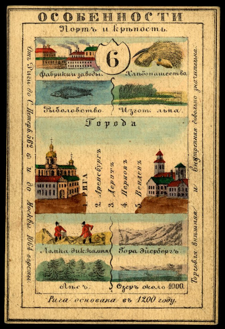
The Mid-19th Century Russian Empire was so large that it covered over 15% of the world's land area. It included a huge mix of ethnic, linguistic and religious groups. One way to show their imperial pride was to create sets of cards representing their many provinces. Here is Lifland Province (Latvia)
For example, Kamchatka
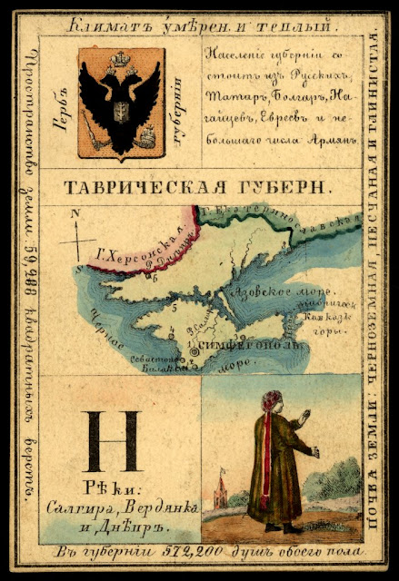
Here is Tavrich (Taurida) Province, including Crimea claimed then as it is again now by the Russians.
To browse the map. for more cards click here.
These cards listed principal cities, agricultural and industrial products. They also show coats of arms and local clothing styles. On the back side was usually a map.
The cards are from the National Library of Russia and The World Digital Library has put images of them online. They can be browsed from an interactive map that also has an overlay of a map of the Empire from 1827-the approximate time period of the cards. Click on the numbers to see the cards.For example, Kamchatka
Here is Tavrich (Taurida) Province, including Crimea claimed then as it is again now by the Russians.
To browse the map. for more cards click here.


2 comments:
My husbands grandfather listed 'Tavrick' as his birthplace on his 1917 Naturalization card. Is Tavrick the same as Tavrich, and is that now Simferopol on the Crimean Peninsula?
I think Tavrich is the name of the former province or region that contains Simferopol but I don't know for certain.
Post a Comment