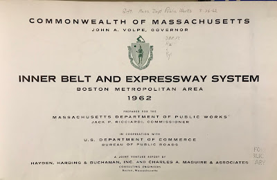
Recently I went to a meeting at the public library in Medford, Massachusetts. With some time to kill beforehand, I browsed their map collection and came across this atlas put out by the state (excuse me, Commonwealth) in 1962.
It shows the existing and proposed highways. Here is an optimistic assessment of the reduction in travel times that would result from the proposed expressways.
The green lines are the travel times in 1945 while the red lines are the forecasted times in 1975 after the highway system was expected to be complete. Dotted gray lines are the proposed highways, most of which were never built due to a combination of powerful local opposition and budget constraints. Note how the red lined areas expand along these corridors. With or without expressways the notion of getting downtown within 15 minutes from most of the area below is very quaint.
The plans included a central ring, the Inner Belt or Interstate 695, that was to be built through neighborhoods of Boston, Brookline, Cambridge and Somerville. There were also proposals for a northwest expressway connecting Route 3 to I-695 and one for the Southwest Corridor alignment of Interstate 95.
Much of the housing along the Southwest Corridor was cleared for the highway by the time the project was cancelled. This land was repurposed for a linear park with a transit route for the MBTA Orange Line and Amtrak's Northeast Corridor. Yes, the Southwest Corridor became part of the Northeast Corridor. Here is a detail showing an area of Roxbury that would have been traversed by I-95.
I'm not sure what the orange-green color scheme is for but it clearly shows how the neighborhood would have been split - like an Atlantic Record.
Here is the interchange between 95 and the Inner Belt. This map has south at the top so it's disorienting. Even more so because so much of this neighborhood was wiped out without the highways being built.
Finally, a detail that hits close to home because it is close to my home - the never built Northwest and Route 3 Expressways.
It shows the existing and proposed highways. Here is an optimistic assessment of the reduction in travel times that would result from the proposed expressways.
The green lines are the travel times in 1945 while the red lines are the forecasted times in 1975 after the highway system was expected to be complete. Dotted gray lines are the proposed highways, most of which were never built due to a combination of powerful local opposition and budget constraints. Note how the red lined areas expand along these corridors. With or without expressways the notion of getting downtown within 15 minutes from most of the area below is very quaint.
The plans included a central ring, the Inner Belt or Interstate 695, that was to be built through neighborhoods of Boston, Brookline, Cambridge and Somerville. There were also proposals for a northwest expressway connecting Route 3 to I-695 and one for the Southwest Corridor alignment of Interstate 95.
Much of the housing along the Southwest Corridor was cleared for the highway by the time the project was cancelled. This land was repurposed for a linear park with a transit route for the MBTA Orange Line and Amtrak's Northeast Corridor. Yes, the Southwest Corridor became part of the Northeast Corridor. Here is a detail showing an area of Roxbury that would have been traversed by I-95.
I'm not sure what the orange-green color scheme is for but it clearly shows how the neighborhood would have been split - like an Atlantic Record.
Finally, a detail that hits close to home because it is close to my home - the never built Northwest and Route 3 Expressways.


1 comment:
If built, Boston would have been destroyed. They even planned to demolish the Museum Of Fine Art. Moving the Orange Line to the corridor was the correct decision.
Post a Comment