
Despite the remarkably little press the massive wildfires in California are getting here in the eastern United States, the best sources for maps are from the New York Times and other non-California news organizations. The Times has a fantastic video of the smoke plume over the past week. Unfortunately the code they provided to put it below did not work so here is a small piece of it.
 You can see the entire country here - scroll down the the end of the page. Some of the smoke plumes are shown traveling completely across to the Atlantic Ocean.
Popular Science has a great map showing five years of fires-updated to six including this fire season.
 The best map I've seen showing the current conditions is from the BBC.
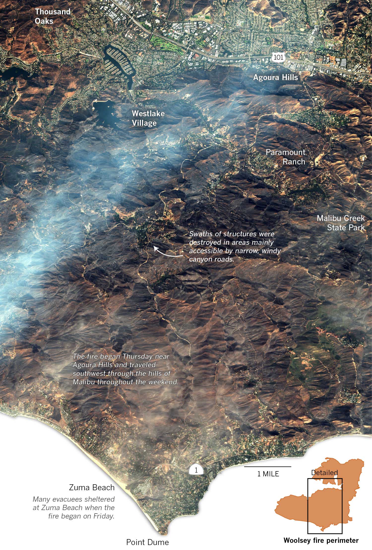
 The Los Angeles Times has a great graphic (via DigitalGlobe) showing the Woolsey Fire near Malibu. To see some zoomed in views showing specific houses that were destroyed click here.

Popular Science has a great map showing five years of fires-updated to six including this fire season.


No comments:
Post a Comment