In 1816 mapmaker
John Melish drew the first coast to coast map of the United States.
By extending this map all the way to the Pacific, he implicitly laid claim to these lands for the United States. At the time there were competing claims in the west between the United States, Great Britain and Spain. In his own words "part of this territory unquestionably belongs to the United States." Map it and it is yours. The power of the map's claim was such that it was used in future treaty negotiations between the United States and the European powers.
I had a chance to look at and photograph this map up close at the
Map & Atlas Museum of La Jolla.
Melish had the benefit of information from Lewis and Clark's recent expedition to fill in many details. Here rivers with fancy names like Philosophy (Willow Creek) and Philanthropy (Ruby River) make their way to the Jefferson and eventually Missouri Rivers.
Sometimes the details are a bit exaggerated.
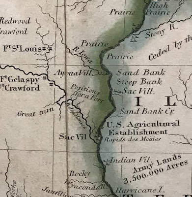
Here are some very detailed annotations along the Illinois-Iowa (Missouri Territory at the time) section of the Mississippi River.
In addition to the map's historical significance there are various other cartographic curiosities such as the incorrectly angled Lake Michigan, missing Illinois completely and putting Michigan on a diet.
Chicago's there, just in the wrong state.
Here is another curiosity
A theorized link to San Francisco Bay via the Rio Buenaventura (Green River in Utah) - here is a zoomed out look.
The entire map can be browsed at
World Digital Library


No comments:
Post a Comment