Cartographer Daniel Huffman hosted a monochrome mapping competition on his blog. He posted the results yesterday. Keep in mind that monochrome does not necessarily mean black and white. It refers to two colors, usually a foreground color (often black) and a background color (often white) with shades (ie. grays) of in between color. In the case below the foreground color is green with a pink-ish background.
Here are some of my favorites. Click on them to see the maps in their entirety.
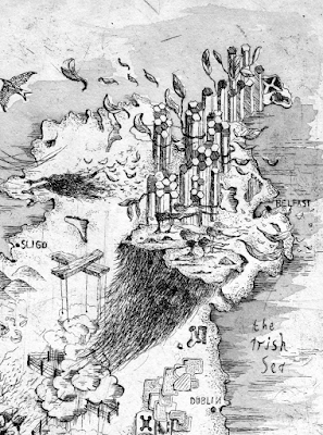
Ireland by Alex Hotchkin. Some of the details are a bit fanciful and I'm not sure what those stone (?) formations are north and west of Belfast. Here is a bit of the southwest.
For a more computer produced but still beautiful look here is an Appalachian Trail fold out shelter map by John Nelson and Erich Rainville using a blue-white color scheme.
Here is a map of Iturup, one of the Kuril Islands by Heather Smith. The hand drawn topographic shading is particularly nice.
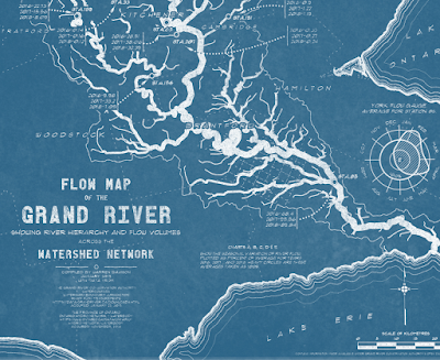
A flow map of the Grand River in Ontario by Warren Davison done blueprint style.
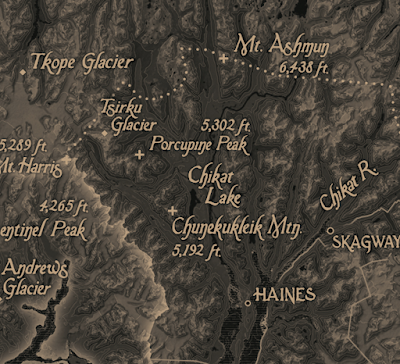
Finally this brown (bistre) and black map of Alaska's Tongass National Forest by Evan Applegate, Matt Strieby, Aiyana Udesen, and Ezra Butt.
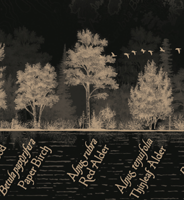
The map faeturse a diagram of the trees of the area at the bottom,
and this nicely done locator map, accompanied by colorful text such as "glaciers hemorrhaging water so blue it hurts your teeth to even look upon't...." It also contains a plea to "write some checks" to prevent the "moribund timber industry" from knocking down more of the old growth forest.
Other highlights include a stunning relief map of Peru, a hand drawn historic map of Paris and a "wealth topography" of LA. To see the full range of maps go here.
 |
| Sarah Bell - Inland Northwest Washington Art Deco Map |
Ireland by Alex Hotchkin. Some of the details are a bit fanciful and I'm not sure what those stone (?) formations are north and west of Belfast. Here is a bit of the southwest.
For a more computer produced but still beautiful look here is an Appalachian Trail fold out shelter map by John Nelson and Erich Rainville using a blue-white color scheme.
Here is a map of Iturup, one of the Kuril Islands by Heather Smith. The hand drawn topographic shading is particularly nice.
A flow map of the Grand River in Ontario by Warren Davison done blueprint style.
Finally this brown (bistre) and black map of Alaska's Tongass National Forest by Evan Applegate, Matt Strieby, Aiyana Udesen, and Ezra Butt.
The map faeturse a diagram of the trees of the area at the bottom,
and this nicely done locator map, accompanied by colorful text such as "glaciers hemorrhaging water so blue it hurts your teeth to even look upon't...." It also contains a plea to "write some checks" to prevent the "moribund timber industry" from knocking down more of the old growth forest.
Other highlights include a stunning relief map of Peru, a hand drawn historic map of Paris and a "wealth topography" of LA. To see the full range of maps go here.


No comments:
Post a Comment