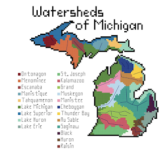
One of the talks I enjoyed at this month's North American Cartographic Information Society Conference was from Kara Prior, who uses maps to create cross stitch pattern designs - on sale on her Etsy shop.
She details the process in her talk - now available on YouTube. The idea is to take a map and make it as low resolution as possible while still conveying information. That way you see the individual squares. Here is a screen shot from the video illustrating this.
One of my favorites is the bedrock geology of Arizona. The colors really jump out - some of them look like they were taken from the state's flag.
She also has bathymetry and watersheds as well as several other, non-map patterns. The watersheds can be quite simple such as New Jersey,
or much more complicated. I'll end with some bathymetry examples


No comments:
Post a Comment