Here is another installment of maps on display at the British Library - part 1 can be found here.
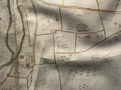
Estate Map by Margaret Bowles, 1659
Apologies for the dark and shadowy picture, the display hall is not brightly lit. Margaret Bowles was an English cartographer whose surviving maps are rare. Her husband and a team of surveyors took measurements of this estate and she transformed the data at reduced scale to make this map. It was made for the estate's managers and is one of the earliest depictions of an English rural landscape.Mapping Mountains in Wales, 1838
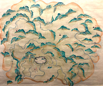
From the library's description: "In the 1830s, Britain’s Ordnance Survey sent surveyors to Northwest Wales to verify data that had been gathered two decades earlier. This is one of the resultant hand-drawn maps, showing the mountainous region of Snowdonia. Its author Thomas Budgen (active 1822-1856) used various drawing techniques to illustrate relief, including close parallel lines known as hill-shading and sketched details of rock formations. At the same time, other surveyors were beginning to experiment with contouring, the relief depiction that is widely used today. Information from this map was incorporated into an engraved map published in the Tower of London from 1838."
My phone picture is not very high resolution but here is a close up to show Budgen's style of relief depiction.
Gilbert and Ellice Islands Separation Stamp
In 1976 the Gilbert and Ellice Islands, a British colony in the Pacific Ocean were separated and eventually became the independent nations of Kiribati and Tuvalu. There is a large image of this map-centric commemorative stamp hanging in this exhibit and also,
a separation of the separation stamp! Here you can see the text separation layer of the artwork displayed on top of the rest of the stamp.


