
While I was at the British Library in May, I spent much time admiring and puzzling over this atlas.

The coloring is quite vivid and exquisite as you can see just from the cover. Here is an example showing the fortified town of Damme, north of Bruges.

The terrain representation on these maps is also interesting.

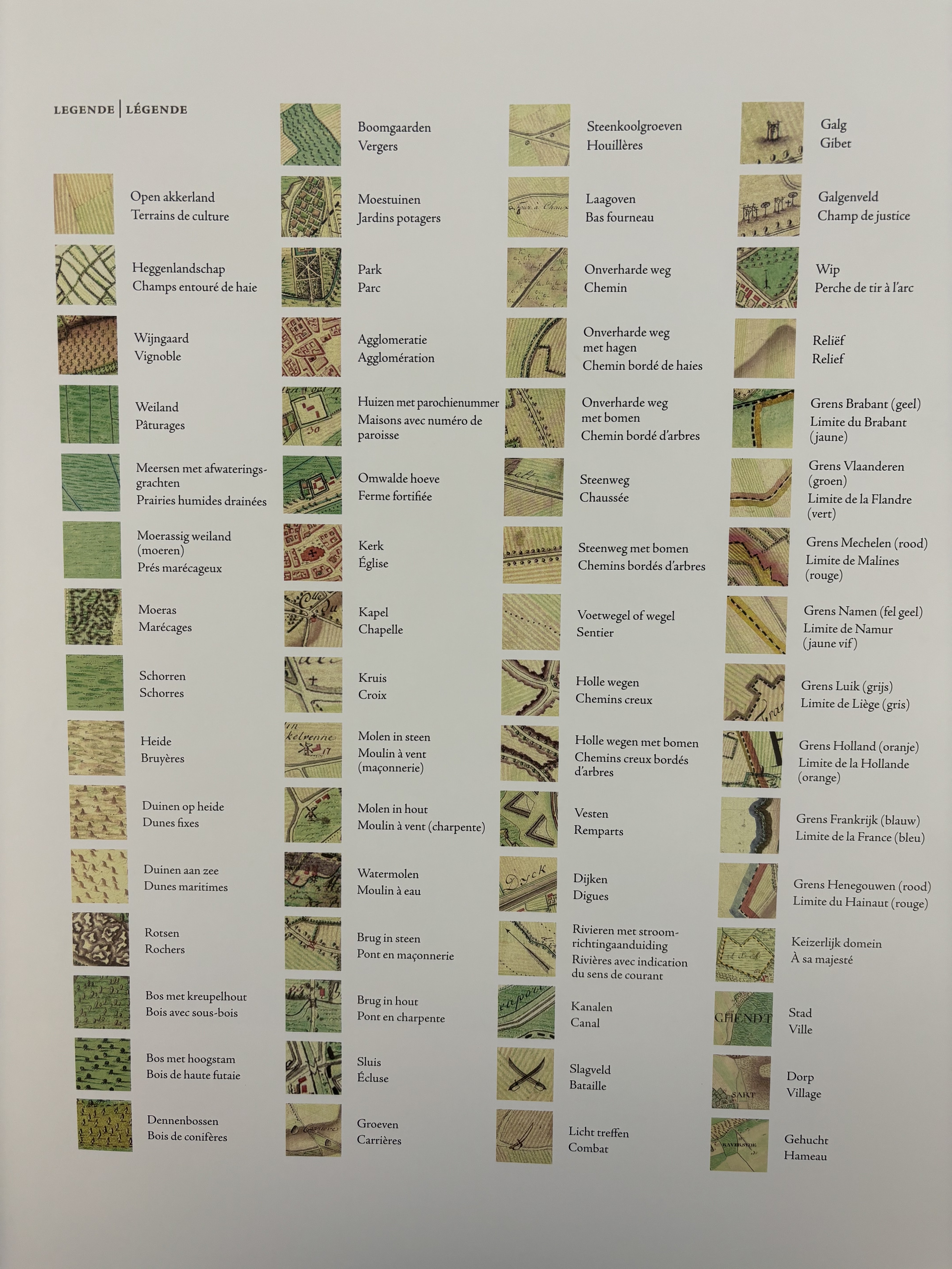
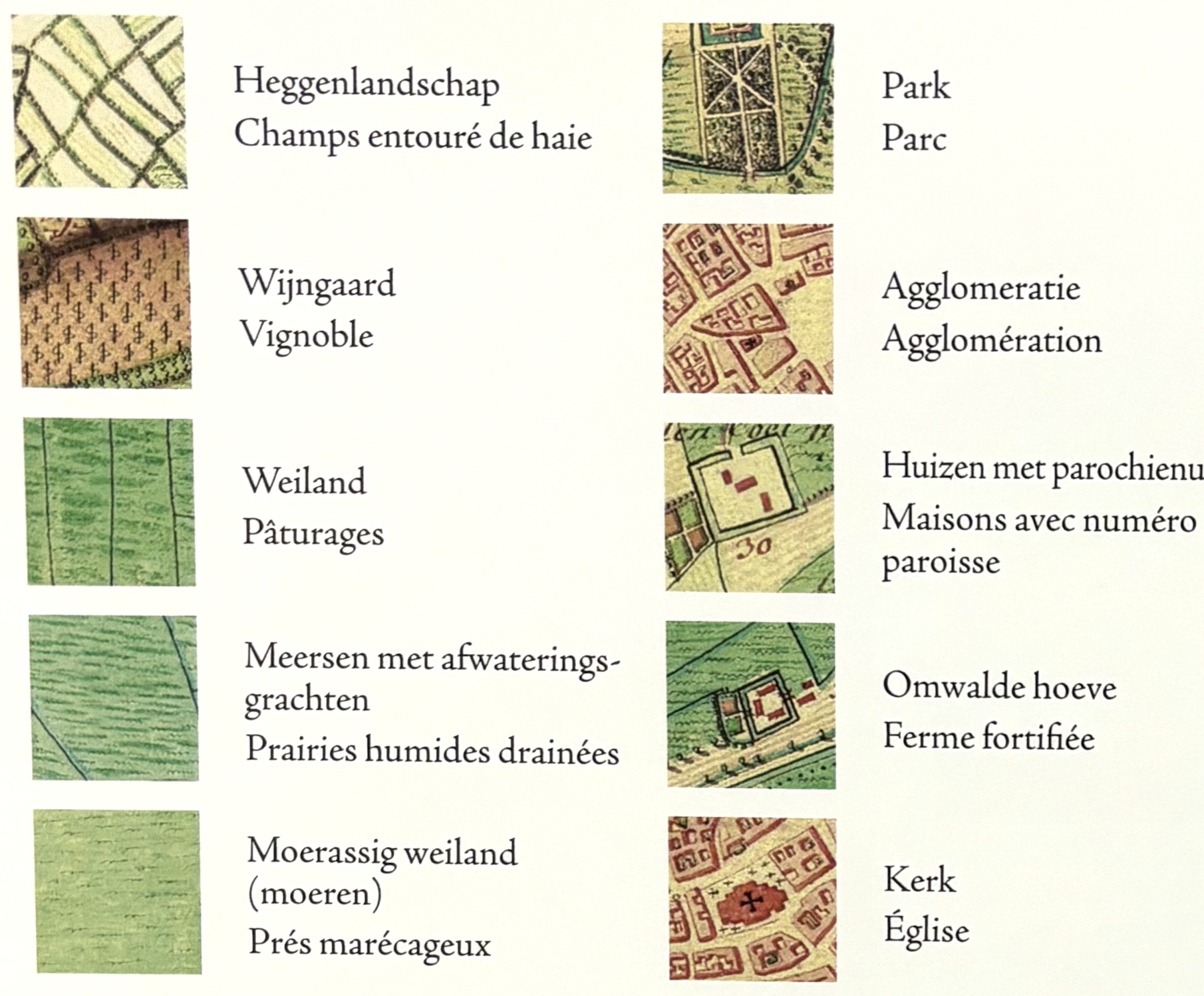
The legend is also well worth a study to see how many different types of land and usage were characterized. The original maps did not have a legend-this one was made for the book edition.
There is some intrigue about why some in-holdings from Holland are shown here as belonging to Austria (Belgium). That region of the Netherlands (Limburg) was heavily fought over and claimed by both countries and neighboring colonial powers. Here is an example of a few around Fauquemont (Valkenburg aan de Geul) in the southeastern corner of the Netherlands.

All 275 sheets of the atlas have been scanned and are available at the National Library of Belgium online. You can browse each sheet here. I will be discussing this atlas a bit more in a future post.


No comments:
Post a Comment