
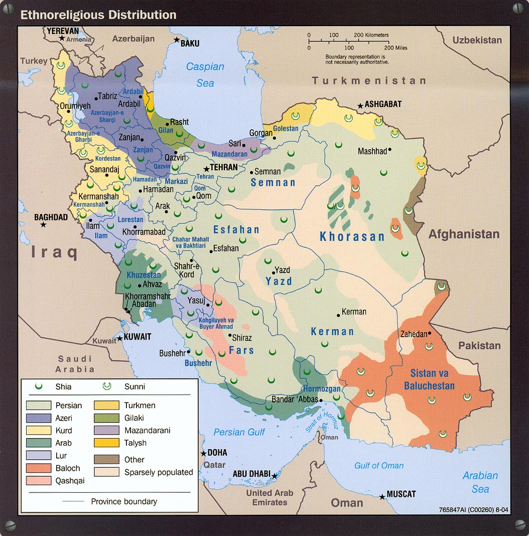
With all that is going on in Iran, it may be useful or at least interesting to see a map of the country’s ethnic diversity. As with many other countries, it is easy to think of today’s boundaries as reflecting homogeneous regions. This map shows a much more complicated picture.
 |
| -CIA map via the University of Texas Map Library. |
According to Wikipedia, Persians, often considered identical to Iranians only make up 51% of the population. Azeri’s (from Azerbaijan) make up 24% and are represented in purple above. Two of the northern provinces are named East and West Azerbaijan and there is speculation that should Iran’s government fall, Azerbaijan might look to grab these provinces. There is also a significant Kurdish presence in this and other regions. Also in the north are some significant minorities along the Caspian Sea coast such as Gilakis and Mazandaranis, whose populations make up 8% of the country’s ethnic breakdown. Less numerous but covering much more land are the Baloch, mainly based in neighboring Pakistan with a significant separatist movement in both countries.
Other significant minorities include Turkmen (on the border of Turkmenistan and whose color is hard to distinguish from the Talysh on the opposite side of the Caspian Sea), Lurs, and Arabs. It is also interesting to see how much area is “sparsely populated”.
The map also indicates many Sunni Muslims in the outermost regions of the country though according to Wikipedia they only make up 5-10% of the population.


No comments:
Post a Comment