
Here's a bunch of random maps. They won't "change the way you see the world" like so many other clickbait-y sites claim. They're just kind of interesting, or pretty, or something. Click on the map for the original source and higher resolution.
Meat Production on Ranches - via Pearson Education though I lost the link.
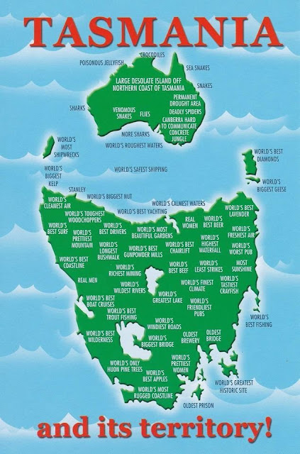
 Tasmania's cartographic revenge - via Reddit
WestJet Destinations, 2000 featuring a Canada without Montreal or Toronto.

Proposed development of Toronto's industrial waterfront, 1910
 - via Toronto Public Library
Saloons, free theatre and "houses of ill fame" in Buffalo, 1893. If you're looking for this neighborhood, it's basically been torn down and replaced with expressways. Easy access from the Children's museum though.

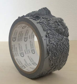
Geo-Eye (Mount Inasa), 2015 by Takahiro Iwasaki carved on a roll of vinyl electrical tape. Iwasaki is a Hiroshima-based artist. Mount Inasa is in Nagasaki.
 Where Europe and Asia would fit in North America climate-wise - via askthebirds
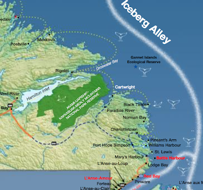
 Tourism map - where to see whales, seabirds and icebergs in Newfoundland And Labrador - issuu.
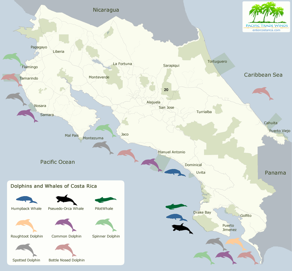
 Whales and dolphins in Costa Rica - via Enter Costa Rica

Meat Production on Ranches - via Pearson Education though I lost the link.

WestJet Destinations, 2000 featuring a Canada without Montreal or Toronto.
Proposed development of Toronto's industrial waterfront, 1910

Saloons, free theatre and "houses of ill fame" in Buffalo, 1893. If you're looking for this neighborhood, it's basically been torn down and replaced with expressways. Easy access from the Children's museum though.
Geo-Eye (Mount Inasa), 2015 by Takahiro Iwasaki carved on a roll of vinyl electrical tape. Iwasaki is a Hiroshima-based artist. Mount Inasa is in Nagasaki.


No comments:
Post a Comment