
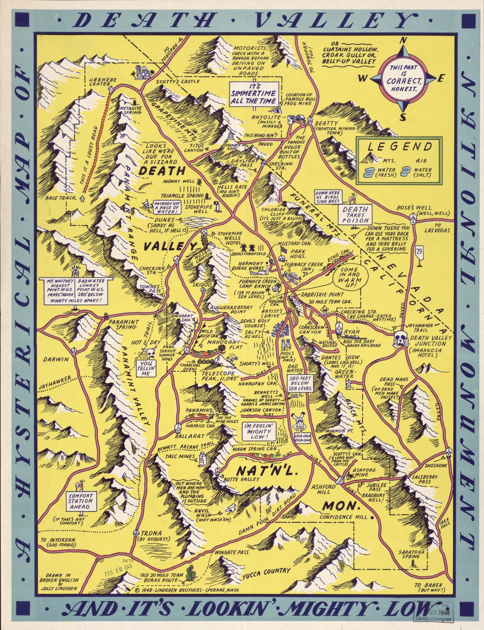
Not to be confused with the Lindgren Brothers maps (one is featured on this blog post) this "hysterical map" predates them a bit.

 |
| Image via Barron Maps |
Like the Lindgren maps, these maps are full of puns and caricatures that might not hold up very well today. I'm not sure what the Iodine issue is in the image at the top but it was in the cows and the vegetables. Some nice touches include the magnetic/pathetic north arrow,

the ancestor worshiper, "not dead (unfortunately)",

and the non-angel in the upper left corner.

The scale of the map is listed as 5 miles to the gallon and the politicians are sleeping outside the Capitol Building in Columbia. You can view the third edition here.
It is not clear how much the Lindgren Brothers may or may not have taken their ideas from this map but they are very similar-as seen here.


No comments:
Post a Comment