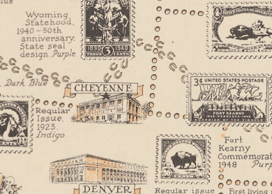
This map was created in 1947 for the 100th anniversary of the first United States postage stamp. Authored by Ernest Dudley Chase of Winchester, Massachusetts (one town away from me), it shows stamps that mark geographic locations across the United States.
Even Lake Okeechobee is perforated.
There is a brief history of postal delivery from the early Persian kings hovering over the Minnesota-Dakota border area. It includes the US Postal Service motto and seal at the bottom.
The north arrow has the USPS sesquicentennial stamp in the middle and is flanked by postmarks from various locations including Winchester, Mass.
The Pony Express Route is detailed in horseshoes.
Along the top are a series of stamps showing educators, authors, poets, scientists, etc., while along three sides are various other commemorative stamps. The color of the stamps is listed because this appears to have been made with a two color press.
A little text area hovering over Dallas: "Postage stamps are beacon lights of history, monuments of heroes, gems of art, disseminators of universal knowledge, records of achievement, and mute witnesses to the rise and fall of empires." Heavy.


1 comment:
annexed a bit of Ontario
Post a Comment