There's a lot of good cartographic content on
flickr. I was looking for something else on a flickr group titled
The Paper Cites- Speculative and Unbuilt Structures, when I came across this image from a user who calls himself
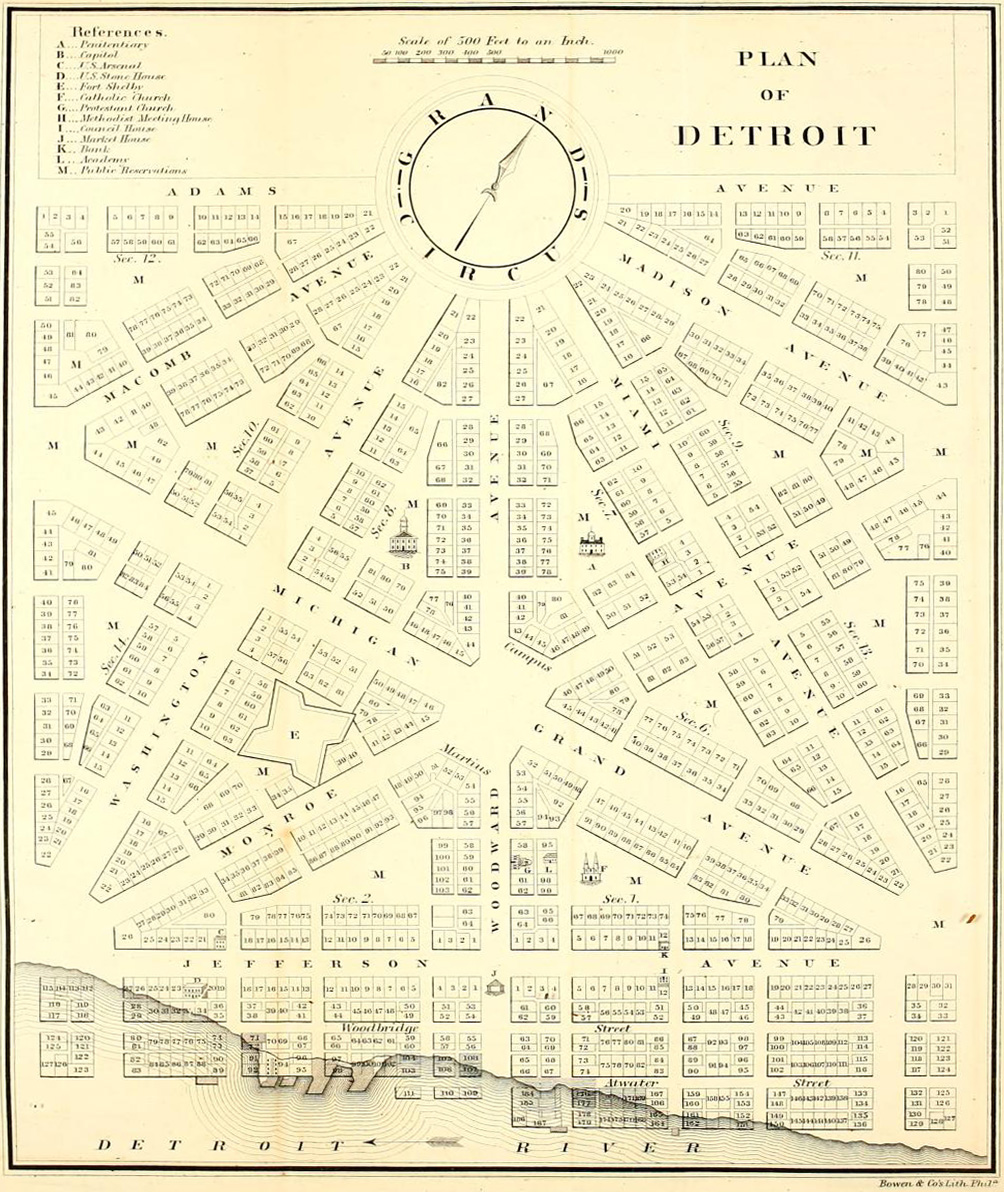
whitewall buick. It shows the "Governor and Judges' Plan" for Detroit after the1805 fire destroyed the city. This plan was based on L'Enfant's plan for Washington DC with a series of plazas and wide boulevards radiating outwards. The shaded area is what was actually implemented.
According to the poster, the remaining areas grew haphazardly because the city was not given the authority to force private landowners to subdivide their land according to the plan. Unfortunately much of the content on flickr is poorly attributed and he does not give much more information.
Here is a map the current street network (and what was ruined) from
Detroit Yes! I suspect this map is a bit out of date because it does not show the Campus Martius Park (see below.)
Michigan Territory Chief Justice
Augustus B. Woodward proposed a plan of hexagonal blocks with the Grand Circus as the central point.
The Campus Martius, a few blocks south of the Grand Circus, is the point of origin for Michigan's coordinate system of roads that includes the Seven and Eight Mile roads located at those distances away.
Here is a photo of the point of origin marker.
Campus Martius Park has recently been redeveloped into a very popular city park with fountains, performance spaces and an ice skating rink.


1 comment:
Hello! I came across your blog in my thesis studies on Woodward Avenue. Interestingly, this poster is pretty grounded in fact. See Silas Farmer's 1884 text here:
http://books.google.com/ebooks?id=2dtMHBxD6R8C&source=gbs_slider_user_shelves_7_homepage
This book documents the struggle for land in the city of Detroit in great detail-- former land-owner farmers did not want to give up their large plots for the proposed small city lots. "Believe us, Governor, no town will ever exist in these marshes." (Chapter V, pg. 25)
There is a nice map of the extension of city limits over a period of several years as well.
Post a Comment