
Yes, November is the month when I get to be self-indulgent and show off my #30DayMapChallenge maps so here come some more. The daily theme is listed after each day.
Day 4 - Green
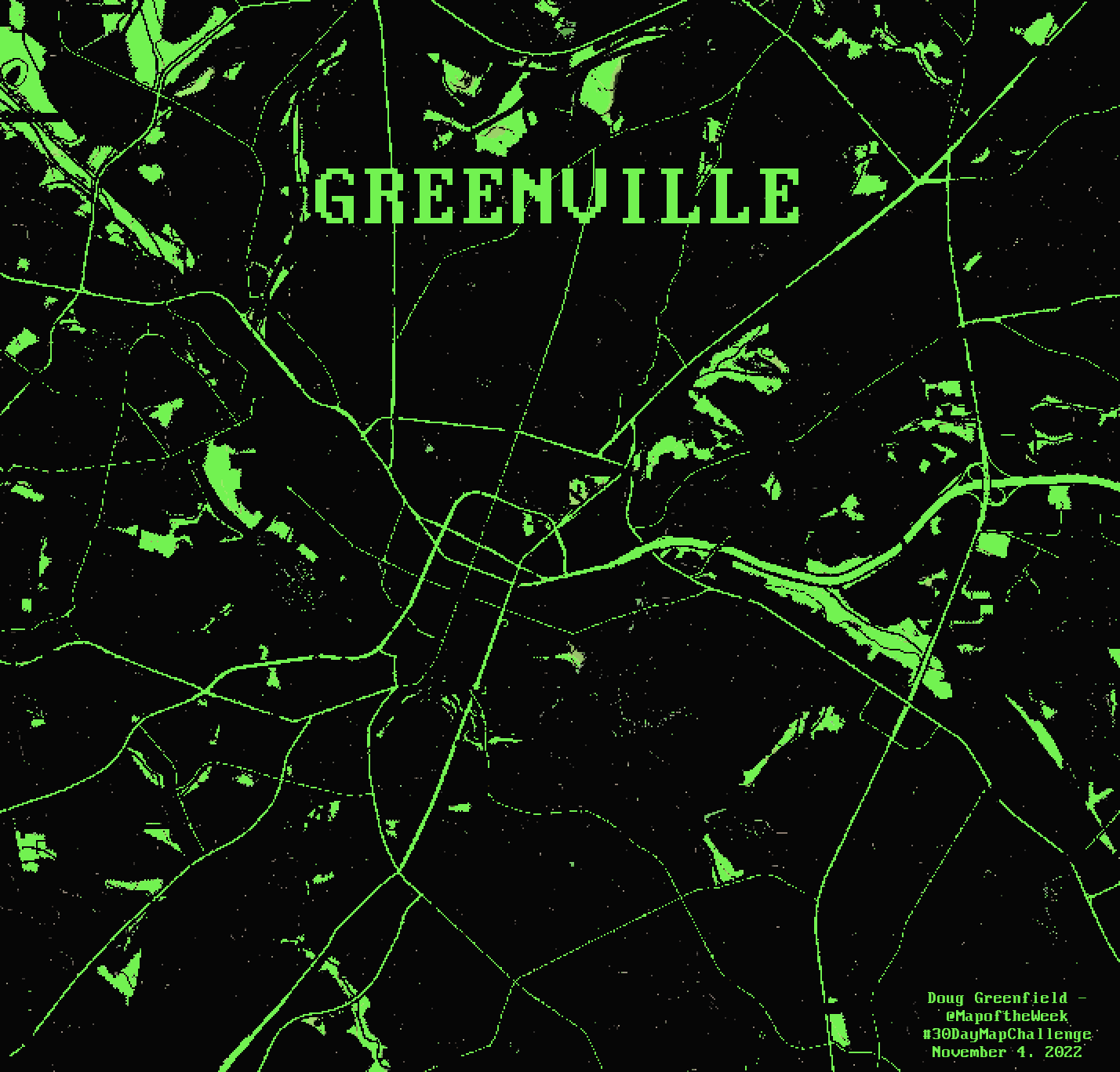
For green day I made a map of Greenville, the one in South Carolina, giving it the 1980’s computer screen look. I brought down the resolution a bit for the pixellated feel and found a font from that era.
Day 5 - Ukraine
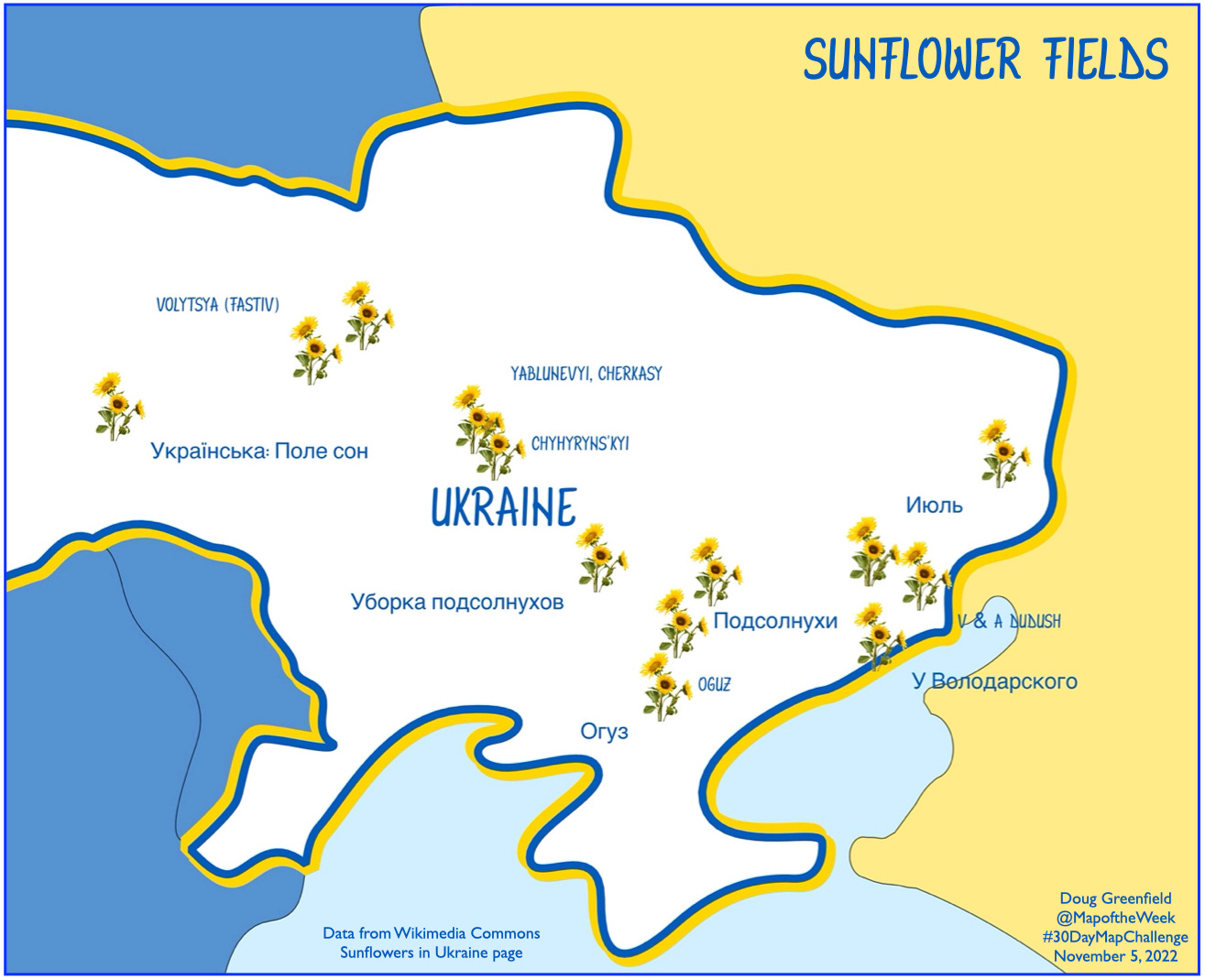
Locations of sunflower fields in Ukraine were taken from this Wikimedia Commons page. Most of the photos have location coordinates listed deep in their metadata. I used a caricatured country outline from Project Linework, except for Russia (not included in their data) which I drew my own coastline for.
Day 6 - Network
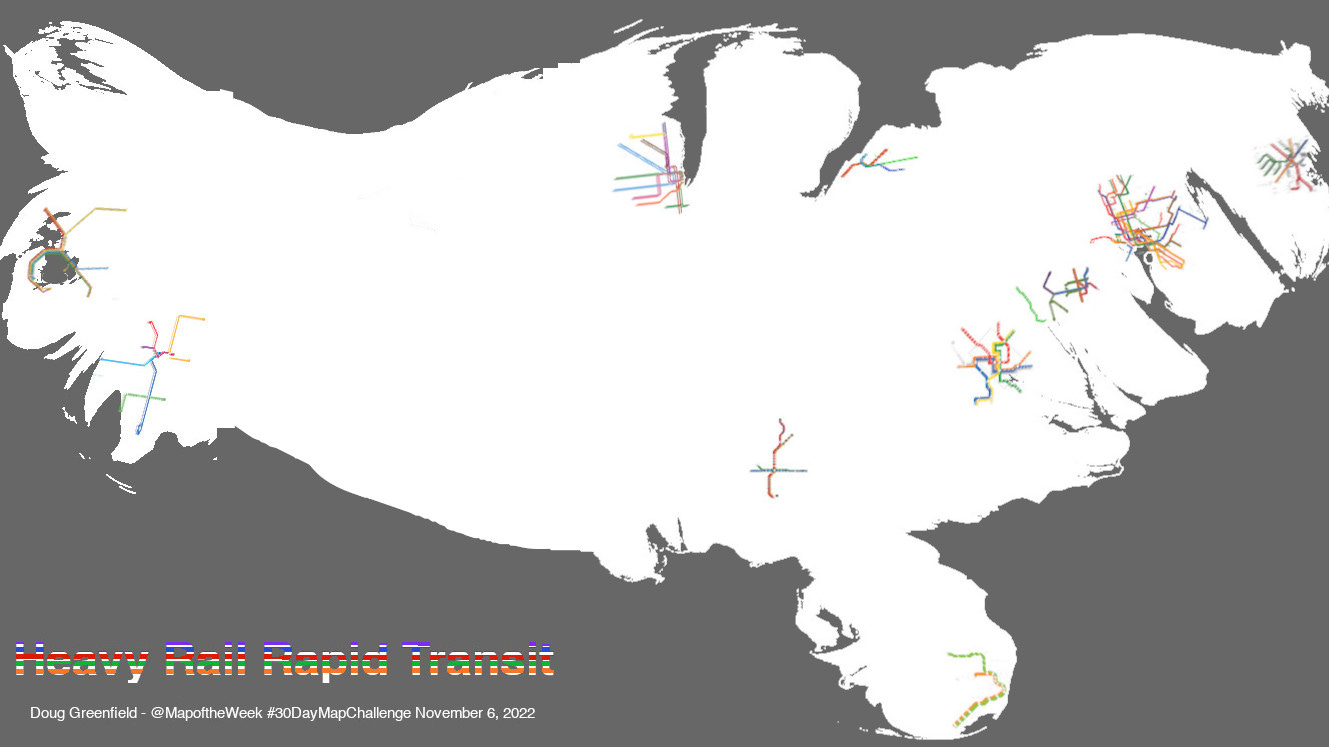
This was not my most successful idea but I’d been working on overlaying transit maps onto a cartogram (so the large urban areas have space). To be as objective as possible and keep this project from blowing up, I only used the “heavy rail” systems as listed by Wikipedia. The page lists 15 systems covering 12 metropolitan areas. I did not include San Juan, Puerto Rico because it’s not part of this cartogram. If I started including cities with “light rail” systems, I might need to add various suburban commuter systems and it would be a large slippery slope that I might never get up from. The cartogram was modified to remove some of the large empty area between Chicago and Los Angeles.
Day 7 - Raster
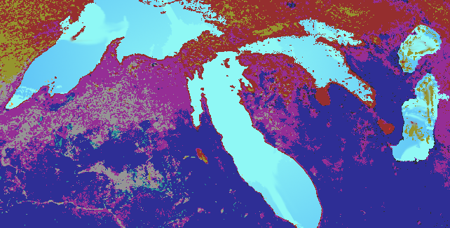
I may have “mailed this one in” a bit but I wanted to play with some color manipulations in GIMP. The original image came from this page from University of Michigan. I like the perspective.
Day 8 - OpenStreetMap
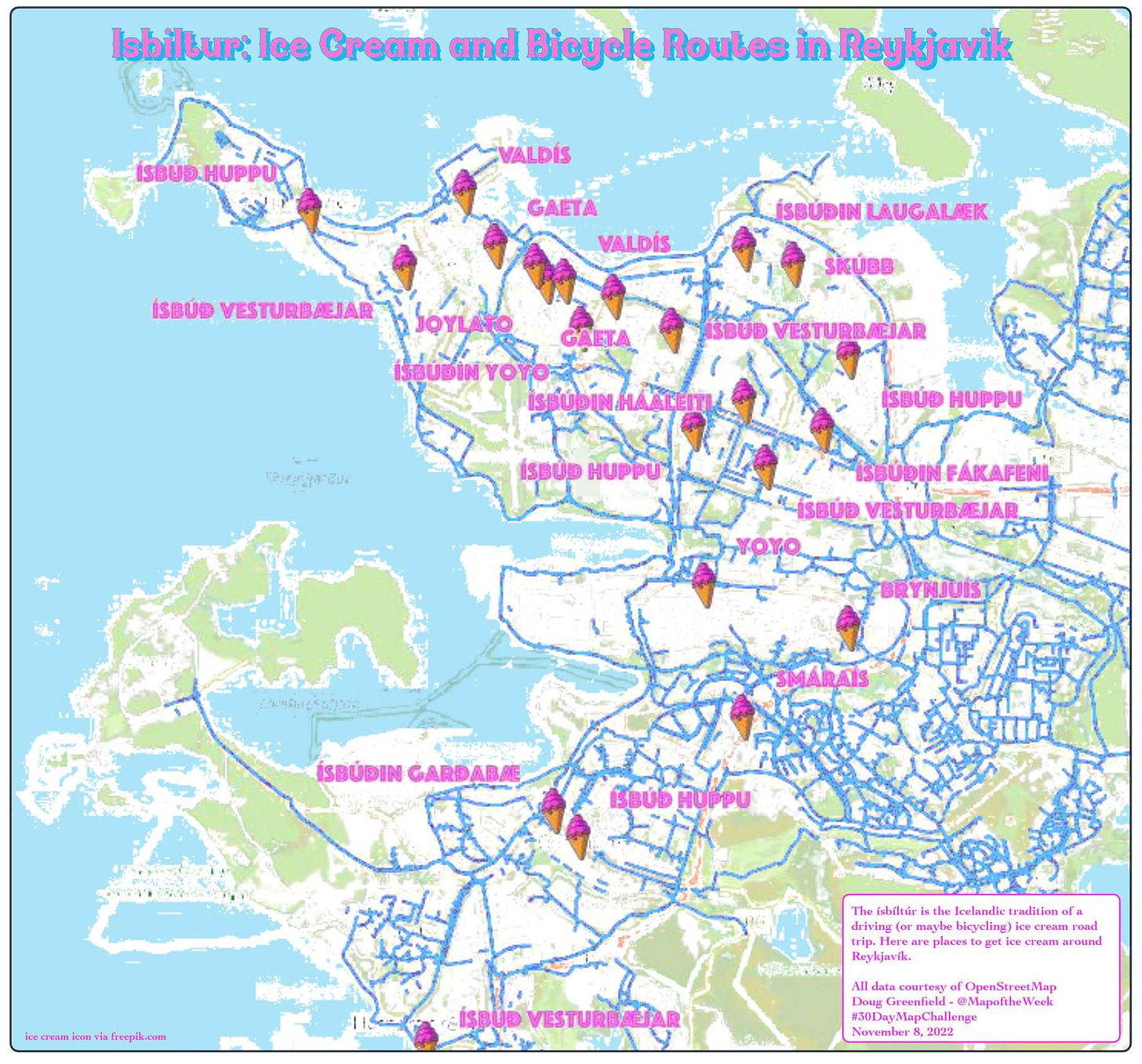
OpenStreetMap is the Wikipedia of geodata. I grabbed some ice cream places and mapped the Ísbíltúr - Iceland’s ice cream road trip tradition. All data including the coastlines and parks are from OpenStreetMap.
Day 9 - Space
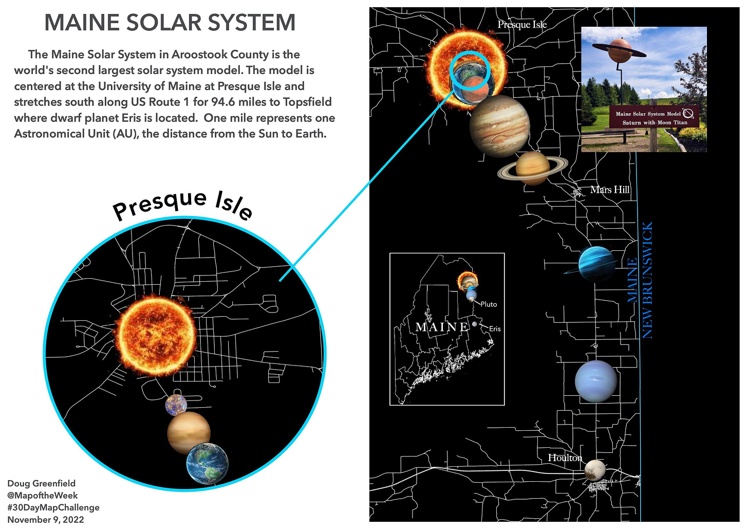
I’ve never been to the Maine Solar System in Aroostook County but I hope to see it some day. Here is a map showing where the planet models are located. More on the system here. The picture of Saturn in situ was taken from Google, user Amy Doucette.


No comments:
Post a Comment