Here’s what I’ve been working on for the past week’s 30 Day Map Challenges with the prompts listed.
Day 3 - Polygons
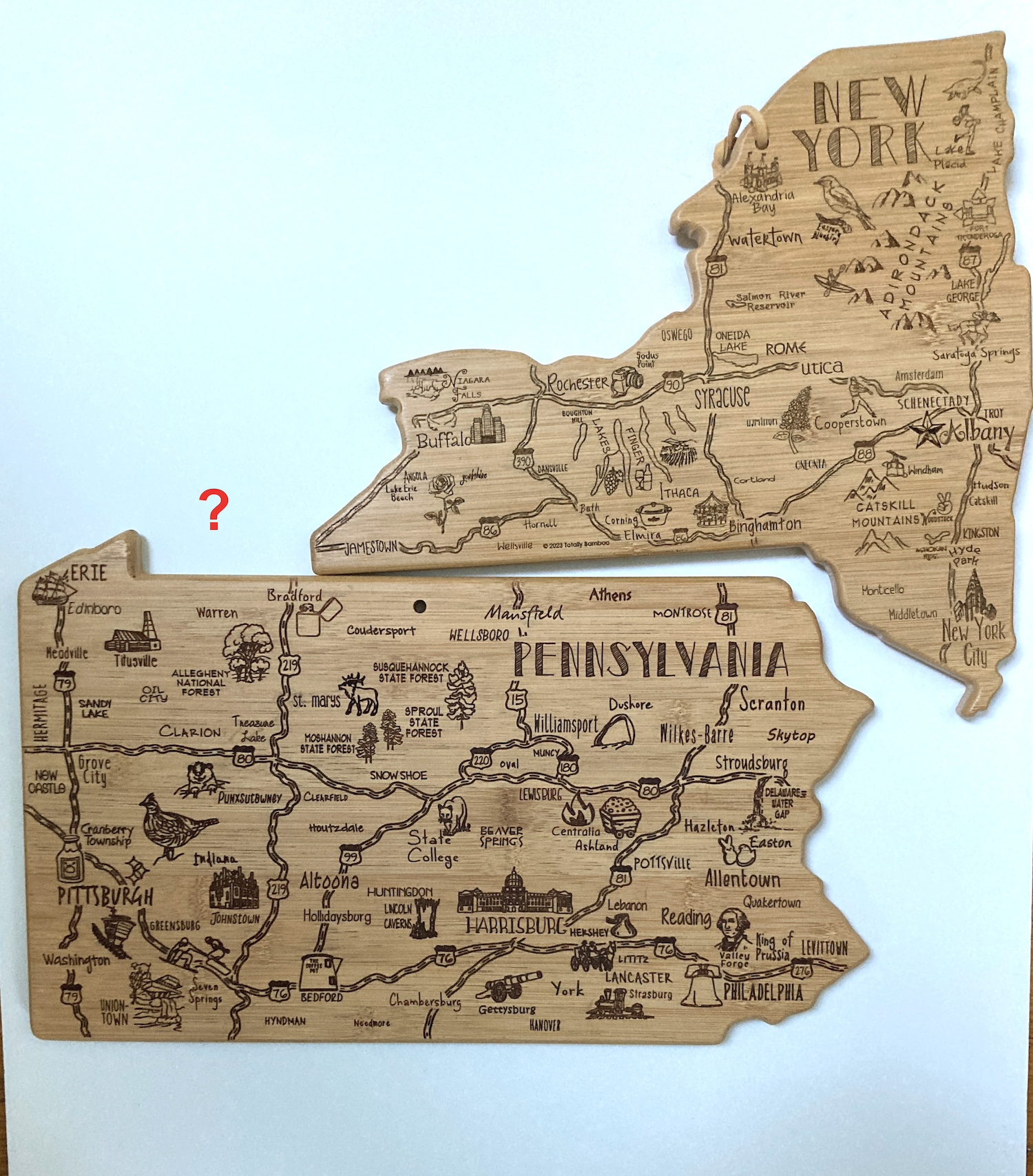
This is not exactly a hand made map, more having fun with cutting boards. My wife gave me the Pennsylvania board a few years ago and I used it in the 2021 challenge as seen here-a map of GDP by metropolitan areas. Her brother just gave me the New York version and hey, they don’t fit together. I guess I shouldn’t expect them to be scaled - the Delaware version would only fit a clove of garlic.
Day 4 - A bad map
A map of Lake Okeechobee zoomed way too far in. Could be any lake but Okeechobee is a great name. There could be a lesson here about maps losing their utility when you’re too far zoomed in or maybe it’s just a cheap lazy joke.Day 5 - Analog (ie map without a computer)
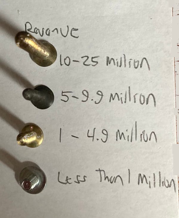
Screw manufacturers. I had an idea in at night when not sleeping about doing a map of nail manufacturers in the USA. The idea came to me because as a college intern in Albany doing local property history I found that there were many nail shops in my neighborhood. It turns out that most nails are imported now. So I did screws instead. The data source (Thomas) is biased towards their featured products but there’s contradictory info online and I needed one stable list. Here is the legend from a readable angle.
Day 6 - Asia
Album covers by the band Asia, who of course are from England. I don’t love how they turned progressive rock into pop treacle but their album covers are wonderful. There are more informative topics out there but this one was fun to do.Day 7 - Navigation
I have a friend who has organized a somewhat yearly pontoon boat ride down the Parker River in Newbury, Massachusetts and into Plum Island (really a peninsula) Sound. This year we got stuck on a sandbar. That was the inspiration for this map.Day 8 - Africa
Where do African violets come from? From the Eastern Arc Mountains of Tanzania and Kenya. The version I posted on social media had a small error in the southernmost region. This version is more correct.Day 9 - Hexagons
States of the US as RStudio hex stickers. Hex stickers are a cultural phenomenon among users of R software. They are for different modules (not sure if that’s the best word). I don’t know much about R and but you can make maps with it using the ggplot module (see Wyoming above). If I were a better software user I would have made this map in R but I didn’t have time to figure that out.I tried to make some logical choices here. Maine is the lobstr module, California has a seal and Kansas has a yellow brick road.
Probably more to come next week as I can’t seem to stop myself….


No comments:
Post a Comment