The final installment of this year’s 30 Day Map Challenge.
Day 24 - Black and White
I had no thoughts ahead of time on this one. I wanted to do something with raster data and the easy, quick thing (this often requires taking the easy and quick route) was to grab the Natural Earth dataset that I already have (used for Day 21) and play with the lighting and contrast to create this nice looking map of the Canadian Maritime provinces (excluding Newfoundland).
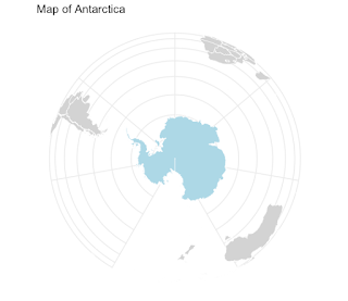
Day 25 - Antarctica
I had been working on a ggplot (an R software package, Wyoming on my Day 9 map) tutorial and knowing Antarctica Day was coming up decided to try it. I had also recently been to a talk about using Chat GPT for making maps so when I wasn’t satisfied with my result asked it to write me some ggplot code.
 |
| My first ChatGPT map! |
I was hoping to convey a sense of fatuousness about these claims. I outlined the UK claim in blue dashes because it overlaps with so many others. Argentina (overlapping Chile, Brazil and the UK) was accidentally deleted from the map.
Day 26 - Minimal
I’ve enjoyed this category in past years though this is probably not a very literal definition of minimal. Various ideas came and went when my map started looking like one of those Portolan Charts of old so I went with it.
I started out with a other water bodies but Lake Erie seemed to meet the criteria best so here it is.
Day 27 - Dots
Massachusetts town centroids. This was a bit of an experiment to see what drawing only the points would look like for a state with a very unique shape. Many years ago I worked for the state Commonwealth and I still had some data floating around. I don’t know about other people but this map plays tricks on my eyes. I see outlines even though there are none.
Day 28 - Is this a chart or a map?
Some maps should just be shown as charts and that is the central idea of this prompt. Instead of delving into that, with limited time I recycled a jokey thing I put on Twitter years ago with a few modifications. The original tweet was about Pennsylvania’s width by longitude, here is the chart (map).
I followed it up with the Vermont/New Hampshire one. The Delaware maps I made this month were another take on this idea.
Day 29 - Population
Here is a good learning experience. China has a large number of cities with populations over 2 (actually 10, keep reading) million. Most of them are unknown to people in the western world. Any one of these cities would be in the top 5 in the United States by city population. The metropolitan area populations might be more comparable but still by that measure most of these cities would be in the top 10. I realized after making this map that my population figures are out of date and there are actually 17 cities with a population over 10 million (via Wikipedia, 2021 data). Some of these cities have come close to doubling their population since the 2010 census, which is probably where the figures on this map came from. If (or when) I have the time, I should remake this map with the current figures.
Day 30 - My favorite…
I struggle a bit with picking favorites - there’s usually multiples for any category and they change frequently. One of my favorite things in the world is chocolate so here is a map titled “The Chocolate Mountains of Africa”
These are cocoa harvesting areas from Earthstat. I used the magic of GIS to show the areas as if they are mountains and then did a little photoshopping to improve the colors. About 60% of the world’s chocolate is produced in two neighboring countries; Cote d’Ivoire (Ivory Coast) and Ghana (source). This is not well conveyed on this map unfortunately.
Wrap Up
That’s it for another year. A few days into the challenge I posted this to my social media accounts:
"The #30DayMapChallenge stages of denial:
I will not participate in this year's #30DayMapChallenge
OK, but I won't take it too seriously Maybe I'll only do a few of them
Ok, but I'm not going to lose sleep over this
It's 4 AM and I'm thinking about hexagons 😵💫"
After a while I got into a nice rhythm with this and I will really miss making a map every day. I’m not sure what will happen when I wake up tomorrow confronted with the emptiness. Maybe I’ll sleep better. Anyway, thanks for reading a month of self-indulgent posts (lots of sentences beginning with “I”) and next week it will be back to hopefully more meaningful content.
Apologies for the uneven fonts and text colors in some of these posts. This old platform has been giving me formatting fits lately. I've tried to keep the colors and the fonts consistent but in a post this large it's very hard to do.


No comments:
Post a Comment